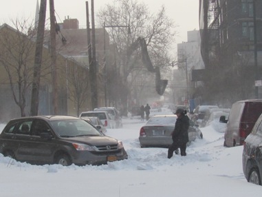
For the first time this winter, the city is getting ready for a potentially powerful snow storm.
According to the National Weather Service (NWS), the flakes should start falling early Friday morning and the bad weather will continue through Saturday.
Earlier in the day, the NWS issued a winter storm watch for all of New York City and other parts of the tri-state area, but by the afternoon had changed it to a blizzard warning with 10 to 14 inches of snow expected.
In addition to snow, the storm will bring powerful winds at 20 to 30 mph with gusts up to 45 mph, and a mixture of rain and sleet, particularly on Friday, making for slippery conditions and possible power outages.
There is also a coastal flooding watch for western Long Island Sound and the Twin Forks of Long Island, said the NWS.
At a briefing on the city’s storm preparations this morning Mayor Michael Bloomberg said that the forecasts may be exaggerating the amount of snow, but you never know.
Bracing for the worst case scenario, the city is ready with more than 250,000 tons of salt, 350 salt spreaders and plows for 1,800 sanitation trucks, said the mayor.
City residents can track the progress of the Department of Sanitation‘s clearing operations for their specific street online.
Con Ed also said it is preparing for the storm and any outages it may cause.
To report any outages and downed power lines, or to check service restoration status, customers can visit www.coned.com/ReportOutage or call -800-75-CONED (1-800-752-6633).
RECOMMENDED STORIES
- Winter tips for the road
- Shadows are no-shows, groundhogs predict early spring
- Brrrrrrrr! How Queens is dealing with the cold