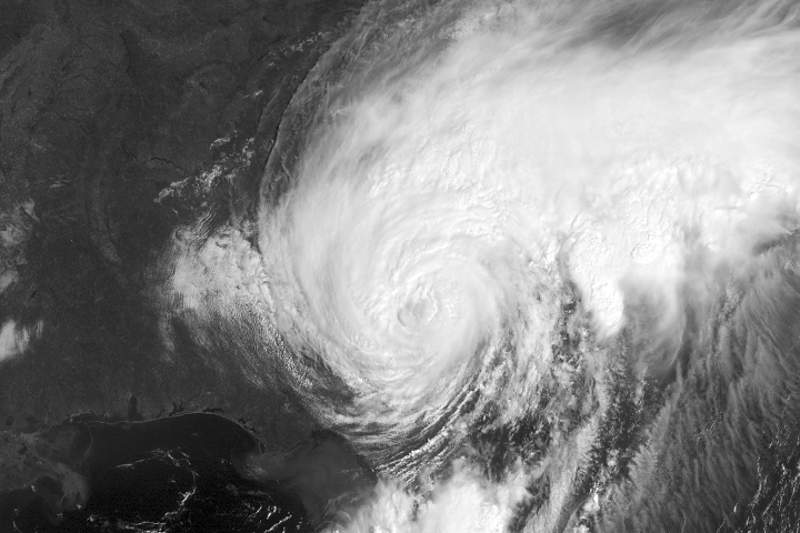
There’s some good news for residents in coastal areas of Queens, as the impact of post-Tropical Storm Hermine may not be as severe as originally forecast.
The former hurricane drifted further out to sea overnight, and that movement has reduced the risk of major storm surges along the northeastern coast.
Queens remains under a tropical storm warning, however, as Hermine is expected to intensify over open water today. It is still predicted to bring tropical storm force gusts and moderate coastal flooding in communities such as Howard Beach, Broad Channel and the Rockaways.
The greatest flood threat is still expected to take place after high tide tonight. High tides are forecast at the Beach Channel Bridge at 10:40 p.m., at North Channel Bridge at 10:46 p.m. and at John F. Kennedy Airport at 11:09 p.m.
Rip currents are another potential hazard related to Hermine, and the city has again prohibited swimming on all beaches on Monday; it had prohibited swimming on Sunday. The beaches remain open for sunbathers.
High winds are still a concern for Queens, as the area could receive wind gusts of 40 to 50 mph. Winds are expected to begin picking up on Saturday afternoon. The Buildings Department has banned all exterior construction work until the storm passes.
Cloud cover is expected to grow later in the day on Sunday, but there likely be much in the way of rain for the New York City area.
Hermine lost its tropical characteristics Saturday after moving over land and cooler ocean water. It is expected to churn off the mid-Atlantic coast for the next several days before heading out to sea.