Old Timer’s Note — We’re indebted this week to Joseph Raskin, one of the city’s foremost transit historians and former MTA director of governmental relations, for this week’s story about the World’s Fair IND, a special subway line in Queens during the 1939-40 World’s Fair.
Two World’s Fairs have been held on the grounds of what is now Flushing Meadows Corona Park, in 1939-40 and 1964-65. Given their continuing service past the park (and possibly helped by a catchy song advertising subway service to the 1964-65 Fair), most people will think that public transit access to the Fairs came only from the still-existing services to the north of the park, MTA New York City Transit’s Flushing Line along Roosevelt Avenue and the Long Island Rail Road’s Port Washington Line.
Another route to the 1939-40 Fair came from the south. In 1937, the World’s Fair Corporation (George McAneny, the corporation’s first president, played a major role in the subway system’s initial expansion in 1913) requested that the New York City Board of Estimate fund improvements to the transit system that would improve access to the fairgrounds.
One project the World’s Fair Corporation called for was a spur line off the Independent City-Owned Subway System’s (IND) Queens Boulevard Line, which was extended from Roosevelt Avenue-Jackson Heights in April 1936. It would run from the 71st-Continental Avenue Station, through the Jamaica Subway Yard and along what is now the northern extension of the Van Wyck Expressway to a terminal south of Horace Harding Boulevard (today’s Horace Harding Expressway, the Long Island Expressway’s service road) by Mount Hebron Cemetery.

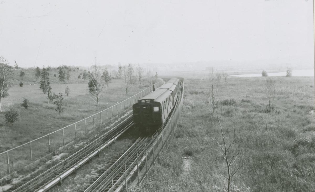
The Board of Estimate approved the plan in early 1938, and the World’s Fair Railroad was built by the P.T. Cox Corporation Company at grade level. Piles and landfill were placed to enable service over the swampy land along the route.
The terminal at Horace Harding Boulevard was different than what had been seen in the subway system until that point, and would still be unique today, built in Art Deco style, keeping with the World’s Fair‘s architecture. The New York Board of Transportation (BOT) operator of the IND (later the entire subway system), predecessor of the New York City Transit Authority, had an exhibit, similar to what would be seen decades later at the New York Transit Museum, explaining the expansion of the transit system and its impact on the city.
As part of the World’s Fair Corporation’s plan, work also took place on the Flushing Line and the Long Island Rail Road’s Port Washington Line. The Willets Point Boulevard Station was expanded and moved westward to its current location (the original Manhattan-bound platform still exists, beyond the east end of the current platform); express service on the Flushing line began.
The Passarelle Bridge, running from the subway station to the park, opened and the LIRR opened a new station at Willets Point to provide access to the Fair.
Service on the World’s Fair Railroad began on April 30, 1939, mostly provided by the GG line, supplemented by some E trains. A double fare was charged, with riders being charged to exit at the terminal, and being charged 10 cents to board at Horace Harding Boulevard. The line didn’t operate in the time the World’s Fair was closed. Over seven million used the Railroad during the 1939 season; 5 million riders used it in the shorter 1940 season.
The World’s Fair closed on Oct. 27, 1940. IND service ended the next day; the line’s infrastructure would remain in place for some time, although the BOT sought its removal. However, Queens elected officials and community groups wanted to reopen and extend the line.

Borough President George U. Harvey raised the issue prior to the Fair’s opening. In 1937, he noted the extension as a means of promoting the growth of the Flushing area. John H. Delaney, the longtime BOT Chairman disagreed: “We recommended a temporary spur from our yards between Kew Gardens and Forest Hills because a permanent line would be useless after two years … The only thing planned for [the park] is a stadium which would seat a maximum of 8,000 persons where an occasional track meet or concert could be held during the summer months. This would mean maintaining a permanent line for traffic, which would be slight…”
Councilman Hugh Quinn discussed the matter with Delaney at a Finance Committee meeting in December 1939. Quinn sought an extension to College Point and Whitestone. “To me, it seems a waste of money to demolish the line if there is any possibility of … building extensions to College Point and Whitestone.”
BOT capital plans from 1929 to 1945 called for a spur line from the Flushing line to Whitestone and College Point via 149th Street and 11th Avenue to 122nd Street.
Delaney again disagreed: “[I]t is not suitably located for extension to Whitestone and College Point. It was built superficially and wouldn’t stand up. It is only a temporary railroad constructed at the lowest possible cost … Rapid transit ought to be built out to Bayside and then through to College Point and Whitestone. That has been our plan for seven or eight years and I am all for it if anyone can get us the money to do it with.”
The neighborhoods to the north and east of the World’s Fair were beginning to grow. They would have benefited from the extension. Queens College had opened in 1937, and would have been helped by direct subway service. Paul Klapper, the president of the college, also spoke in support.
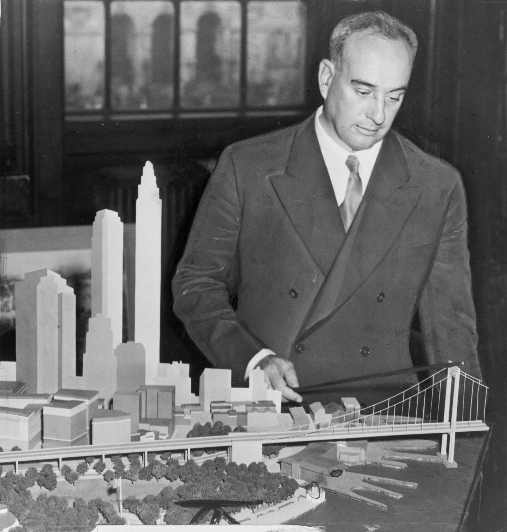
Parks Commissioner Robert Moses backed Delaney. Moses had opposed building the railroad in the first place, and wanted the land to build a permanent park and the eventual northern extension of the Van Wyck Expressway.
Delaney and Moses’ viewpoint won out, and the Board of Estimate authorized removal of the World’s Fair Railroad on Dec. 19, 1940. A similar extension of the Queens Boulevard Line was not considered for the 1964-65 World’s Fair.
Despite the amount of riders that made use of the World’s Fair Railroad, the Flushing and Port Washington Lines and bus service were found to be sufficient.
Old Timer’s Note — Our thanks again to Mr. Raskin for his wonderful and thorough retelling of the World’s Fair Railroad. One wonders how Queens might look today had the city went against the advice of Robert Moses — who, in his 44 years in city and state government, built 627 miles of expressways and parkways, but did very little to expand public transportation.
The extension of the World’s Fair Railroad to College Point and Whitestone is just one of a number of unbuilt subway projects that Mr. Raskin chronicles in his acclaimed book, “The Routes Not Taken: A Trip Through New York City’s Unbuilt Subway System.” It’s available for purchase on Amazon and at local book retailers — and you can also borrow it from the Queens Borough Public Library.
* * *
Share your history with us by emailing editorial@ridgewoodtimes.com (subject: Our Neighborhood: The Way it Was) or write to The Old Timer, ℅ Ridgewood Times, 38-15 Bell Blvd., Bayside, NY 11361. Any mailed pictures will be carefully returned to you upon request.