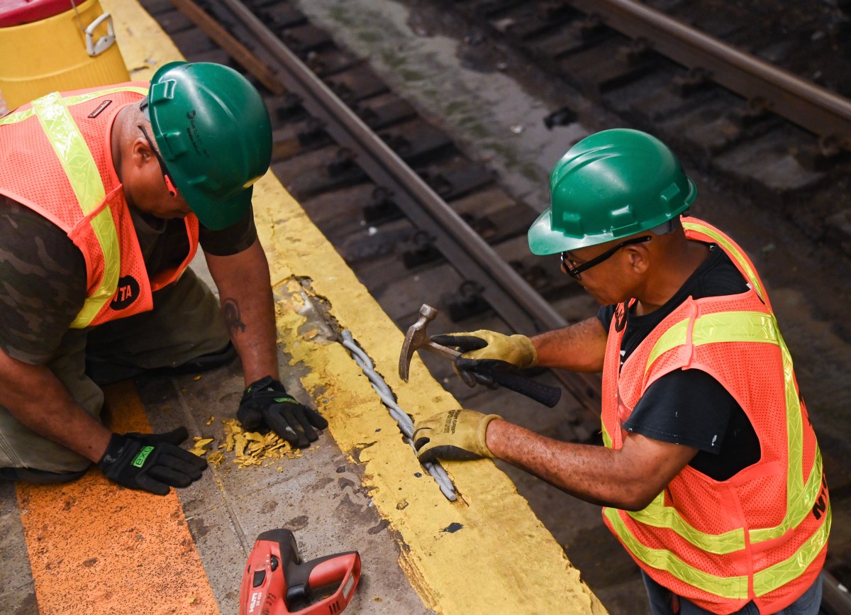
Photos courtesy NYC Municipal Archives, reprinted with permission
Sign up for our QNS email newsletter to get news, updates, and local insights delivered straight to your inbox!
No one has perfected a time machine to take us back in time, so the next best thing we have to get a glimpse of Queens’ past is photography.
In this column, we rely upon some great sources of archival photos such as the Greater Ridgewood Historical Society and The Archives at Queens Library. Both offer a wealth of great knowledge about our history and hundreds of images showing how our community used to be.
We’ve also dug through the NYC Municipal Archives and found some amazing pictures of the Queens streetscape. These photos were taken on behalf of the Queens Borough President’s office between 1920 and 1940, and are among the thousands of images within the Municipal Archives.
We’re incredibly grateful to the NYC Municipal Archives for sharing with us these 10 photos with us that offer a high-resolution glimpse at our past. Enjoy!
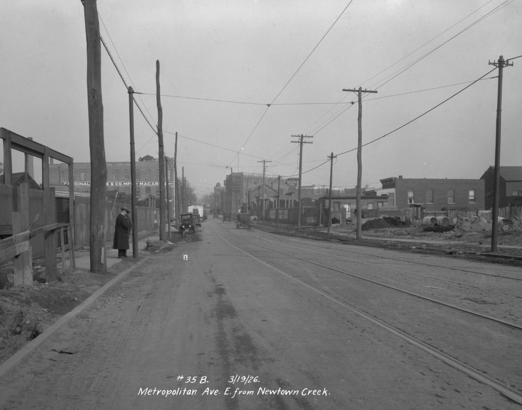
This photo was taken in March 1926 and shows Metropolitan Avenue looking east toward Woodward Avenue in an industrial area of Ridgewood. This vantage point is located about 600 feet east of the end of the Newtown Creek, which marks the border between Brooklyn and Queens in this area. (Courtesy NYC Municipal Archives, reprinted with permission)
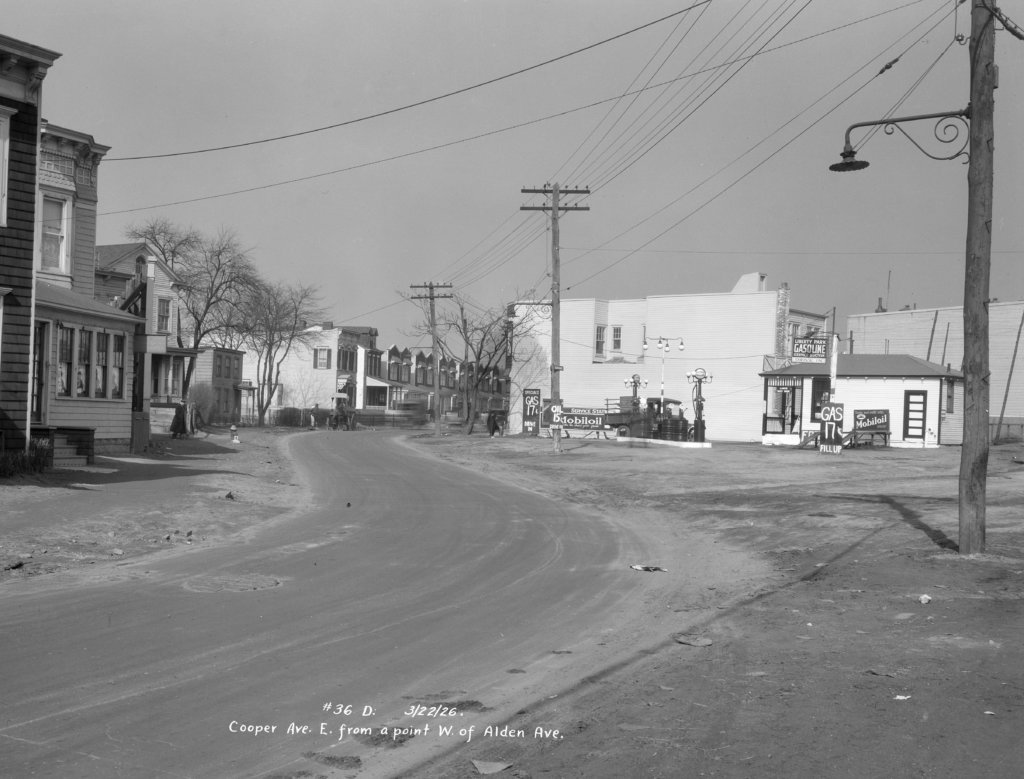
The “Liberty Park” Mobil Oil gas station is shown in this March 1926 photo taken on Cooper Avenue, looking east from the corner of Alden Avenue (present-day 80th Avenue). Back then, gas cost just 17 cents per gallon. (Courtesy NYC Municipal Archives, reprinted with permission)
Cobble stones lined what was then called part of Woodhaven Boulevard, but is now known as Cross Bay Boulevard, at Conduit Boulevard (today’s Conduit Avenue) in Ozone Park. The photographer was looking south when this picture was taken, and you can see the low-lying area of Howard Beach in the background, still not yet fully developed. (Courtesy NYC Municipal Archives, reprinted with permission)
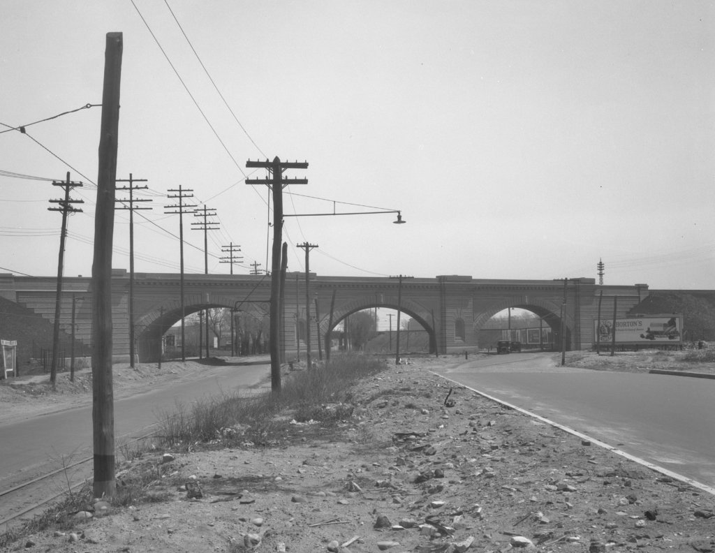
Anyone who drives frequently along Queens Boulevard in Woodside can probably recognize this spot where this May 1926 photo was taken. You’re looking eastbound at Queens Boulevard near the stone arches of the New York Connecting Railroad overpass. The bridge is still used today by freight trains within the CSX system. (Courtesy of NYC Municipal Archives, reprinted with permission)
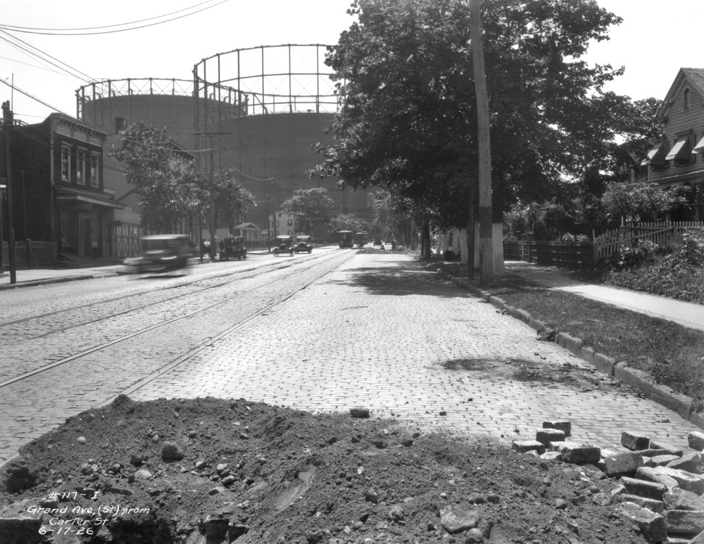
The long-gone Elmhurst Gas Tanks are shown in this June 1926 photo towering over Elmhurst. This image was taken during a street construction project, looking west along Grand Avenue near Carter Place (present-day 83rd Place). (Courtesy of NYC Municipal Archives, reprinted with permission)
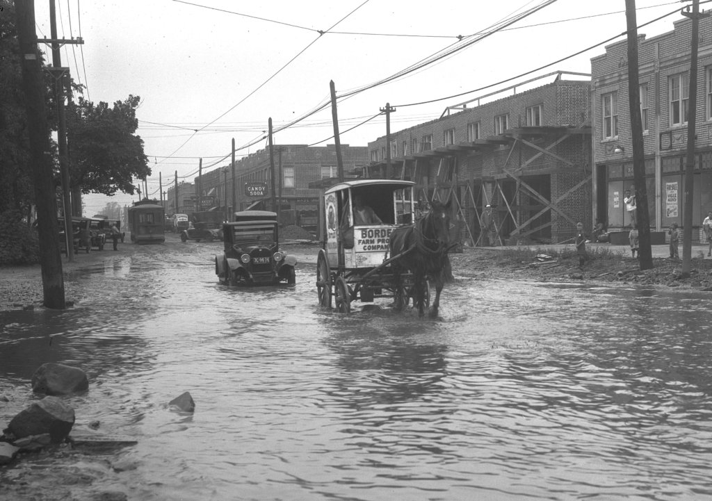
Flooding hit much of Forest Hills following a storm in the summer of 1926. This picture, taken that August, shows a horse-and-buggy, followed by a Ford Model-T, making their way through a flooded Metropolitan Avenue near Ascan Avenue. (Courtesy NYC Municipal Archives, reprinted with permission)
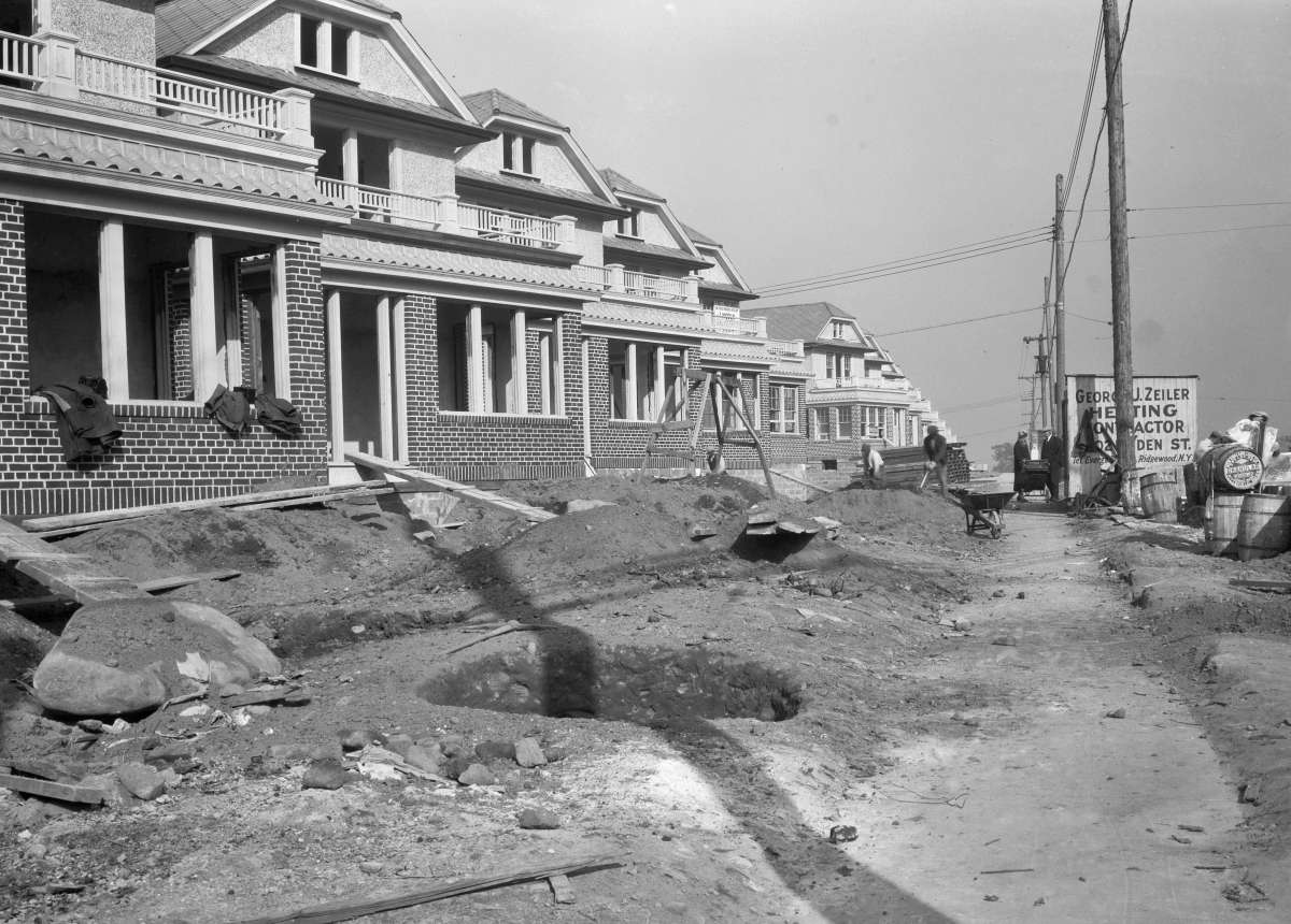
Beautiful homes are shown under construction along Union Turnpike just off of Myrtle Avenue in Glendale in this October 1926 photo. The sign in the distance identifies a heating contractor, George J. Zeiler, of Linden Street in Ridgewood. (Courtesy NYC Municipal Archives, reprinted with permission)
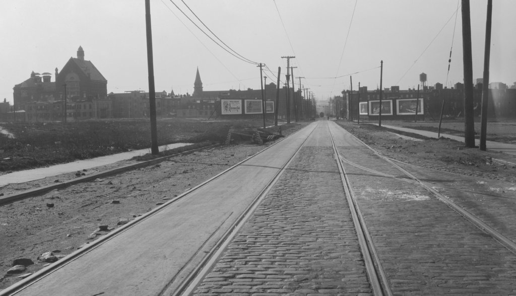
The corner of Seneca and DeKalb Avenues in Ridgewood was an important point in the local transportation infrastructure in December 1926, when this photo was taken. The “car barns” housing local trolleys were located just off the intersection, out of the view of this image. The car barns have long since been demolished; the site now houses the Grover Cleveland High School athletic field. (Courtesy NYC Municipal Archives, reprinted with permission)
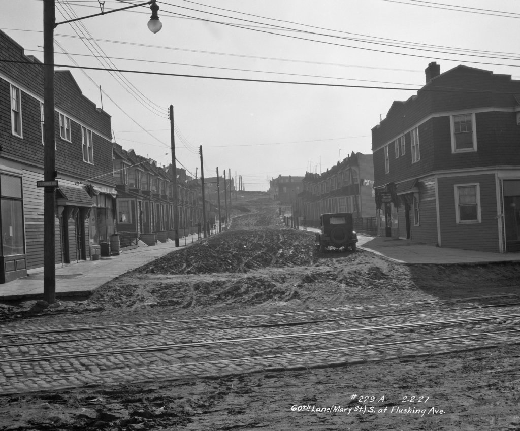
It’s hard to believe, but at one point in time, residential streets in Queens didn’t have asphalt. This February 1927 photo of 60th Lane off Flushing Avenue in Maspeth is proof of that. Note the tire marks in the dirt leading onto the cobblestone-paved Flushing Avenue. (Courtesy of NYC Municipal Archives, reprinted with permission)
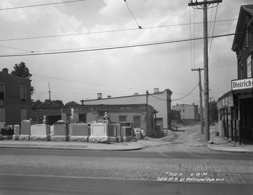
With Lutheran (today All Faiths) and St. John Cemeteries located nearby, Middle Village was once the home of many monument businesses. This 1930 photo shows one of them: Carl Bartasek, who sold tombstones at the corner of Metropolitan Avenue and 70th Street, directly across from Lutheran Cemetery. (Courtesy NYC Municipal Archives, reprinted with permission)
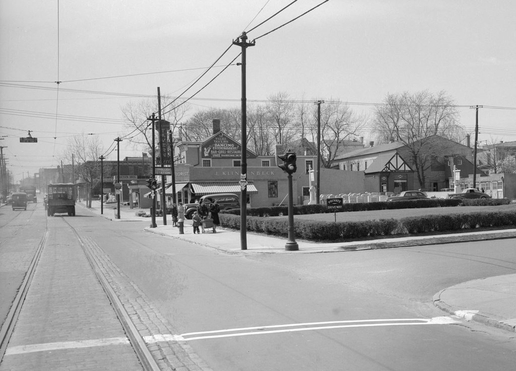
This 1940 photo shows the intersection of Metropolitan Avenue and 80th Street, looking westbound, in Middle Village, close to the main entrance to St. John Cemetery. (Courtesy NYC Municipal Archives, reprinted with permission)
If you have any remembrances or old photographs of “Our Neighborhood: The Way It Was” that you would like to share with our readers, please write to the Old Timer, c/o Ridgewood Times, 38-15 Bell Blvd., Bayside, NY 11361, or send an email to editorial@ridgewoodtimes.com. Any print photographs mailed to us will be carefully returned to you upon request.