Hurricane Jose continues to slowly move up the Eastern Seaboard, but well away from land. Even so, Queens residents could feel some of the storm’s effects starting tomorrow.
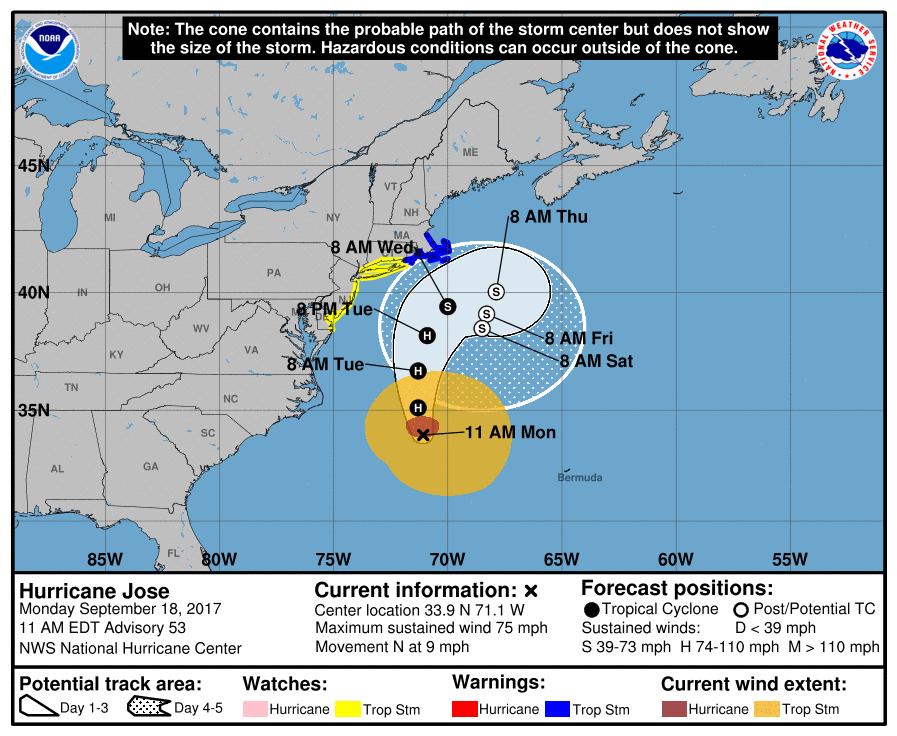
The latest National Hurricane Center advisory has Jose nearly 500 miles south of Nantucket as a Category 1 hurricane with maximum sustained winds of 75 mph, and crawling northward at about 9 mph. Long Island (east of the Queens/Nassau border) is under a tropical storm watch, meaning that the area could experience winds exceeding 39 mph, heavy rain and rough surf over the next 24 hours.
Queens, meanwhile, is under a coastal flood watch, meaning that there’s the potential for minor flooding in low-lying coastal areas such as the Rockaways and Howard Beach, especially during high tide. But the “World’s Borough” is not expected to take a big hit from Jose; areas could receive 1-2 inches of rain, and there may be tropical storm-force wind gusts (39 mph or higher) at times beginning on Tuesday morning, Sept. 19.
While the threat isn’t significant, Mayor Bill de Blasio warned New Yorkers in a Facebook post on Sept. 18 to be on guard.
“Hurricane Jose is heading north. New York City may experience heavy rain Tuesday night through Wednesday,” de Blasio said. “There may be minor flooding and high tides. Follow NYC Emergency Management for further updates and take precautions.”
Though Jose appears to be a minimal threat to Queens, residents might want to keep an eye on Hurricane Maria. The Category 4 storm is expected to make landfall in Puerto Rico on Tuesday morning, then continue on into the Bahamas before making a turn toward the U.S. East Coast by the weekend. Where she goes from there is still too early to say.