By Jeremy Walsh
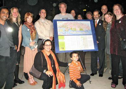
It took three years and a name change, but a coalition of organizations in Astoria and Long Island City has put itself on the map by creating one of its own.
The coalition, Green Shores NYC, was organized by Partnerships for Parks, a joint venture by the city Parks Department and the nonprofit City Parks Foundation, to encourage the use and volunteer maintenance of parks in the area.
It brought together the environmental group Arrow, Friends of Queensbridge Park Committee, the Greater Astoria Historical Society, the LIC Rock Group, the Long Island City Community Boathouse and the Rainey Park Group. Organizers said the group’s members immediately decided a map would help establish an identity for the area’s parks.
“It was the first collaborative effort discussed,” said Karen Overton, a coordinator with Partnership for Parks. “It was like the embryo of the coalition.”
Green Shores NYC President Katie Ellman said she was tired of seeing posters and maps with a vantage point looking in on Manhattan.
“We wanted the viewer looking at Queens,” she said.
The map takes a cartoony, pastel−hued isometric view of Queens’ East River waterfront, with each park’s facilities carefully rendered along with community landmarks, like the KeySpan power plant “Big Allis,” the Noguchi Museum and Silvercup Studios.
Free copies of the map are available at the Greater Astoria Historical Society, 35−20 Broadway, Astoria. For more information, visit www.astorialic.org.
Ilana Teitel, communications director for Green Shores NYC, said she has lived on the Astoria−Long Island City border her whole life.
“I learned more about my neighborhood working on this map than in all the years previously,” she said. “Those neighborhoods meant a lot to people. But until recently, nobody thought of this as a waterfront neighborhood. That’s changing now.”
Cartographer George Colbert said he and Melnick did a lot of walking around to get a feel for the streets.
“It’s a great location,” he said. “Of course, it’s all changing so rapidly.”
Illustrator David Cain, who has worked on several projects for the Partnership before, said what stood out to him was the level of commitment.
“This is a community that understood that condensing 4 square miles into 32 inches is a challenge,” he said.
Richard Melnick, president of the Greater Astoria Historical Society, said he was most pleased to see Old Astoria Village placed on the map.
“Some of the powers that be, signing off on development, are trying to erase some of the past to put in huge glass buildings,” he said.
Reach reporter Jeremy Walsh by e−mail at jwalsh@timesledger.com or by phone at 718−229−0300, Ext. 154.


