Summer officially begins at 11:54 a.m. on Friday, June 21, and for many in Queens, thoughts turn to spending days at the beaches of Rockaway, stepping over hot sand, basking in the even hotter sun and finding cool relief with a dip in the Atlantic.
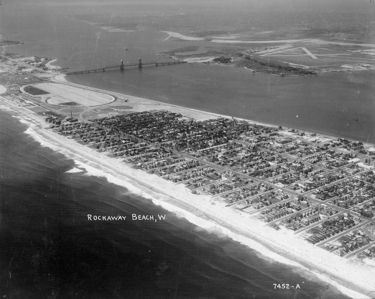
We have two images of the Rockaways from the past that readers in Our Neighborhood will enjoy. Both of these are aerial shots taken during the 1940s.
The featured image above shows the communities of Neponsit and Belle Harbor. If you look carefully, at the left, you can see the oval-shaped parking lot of Jacob Riis Park. One of the largest parking lots in the borough, thousands parked their vehicles there while enjoying a day at the beach, which is today part of the Gateway National Recreational Area.
Just to the right of the parking lot is the twin spires of the Marine Parkway Bridge, the vertical lift span connecting the Rockaway Peninsula with Brooklyn. The bridge would later be renamed for former Mets manager Gil Hodges, who lived in Brooklyn during his playing years with the then-Brooklyn Dodgers.
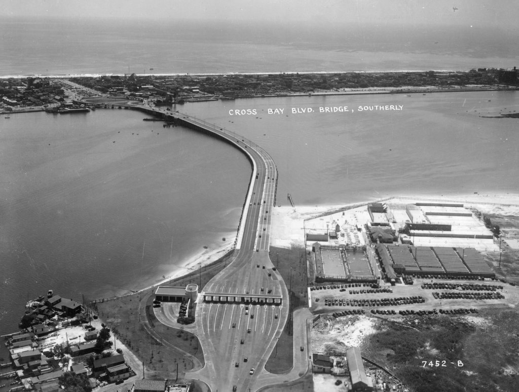
The next aerial photo we have shows what was once the toll booth of the Cross Bay Bridge, connecting Broad Channel and the Rockaways. This image shows the original drawbridge span during the 1940s; thirty years later, it would be replaced with a fixed span.
The toll remains on the Cross Bay Bridge, although recently, it was announced that all Queens residents would be eligible for rebates after crossing the span. Perhaps someday, the toll — like the drawbridge shown above — will be a thing of the past.
Along with these great images of the Rockaway’s past, here are five more amazing photos of Queens from long ago. We again are grateful to the NYC Municipal Archives for allowing us access to these incredible images. The Archives are home to hundreds of thousands of historic photos and documents telling the story of our city the way it was.
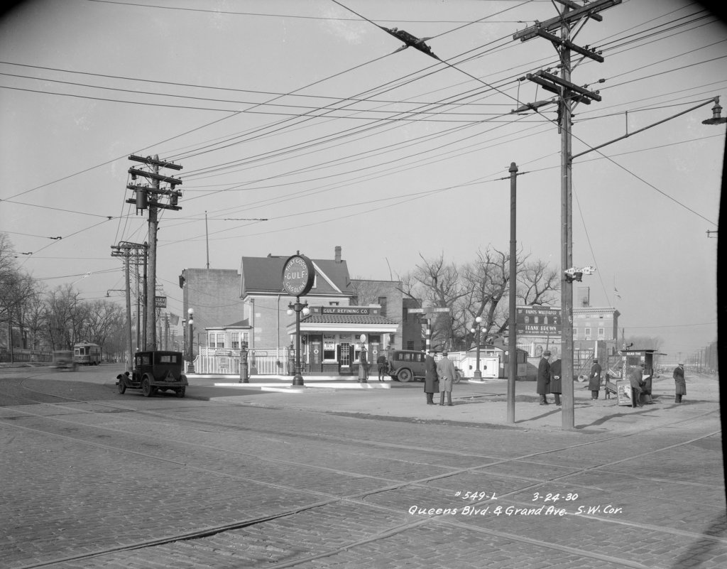
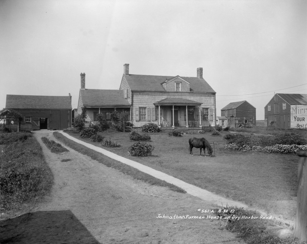
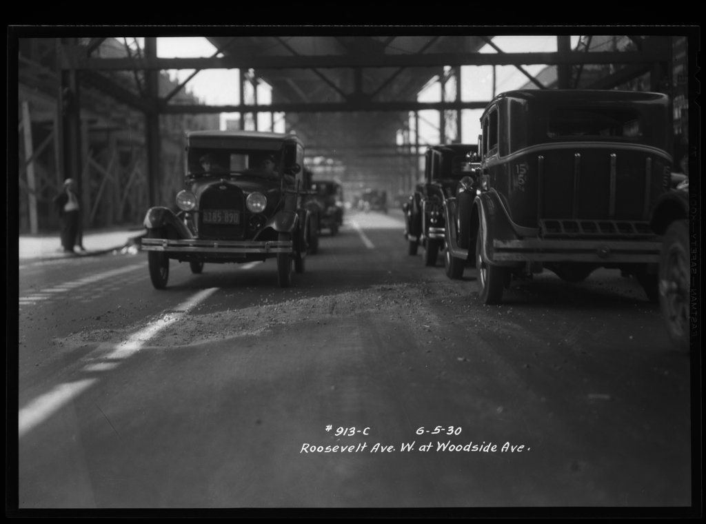
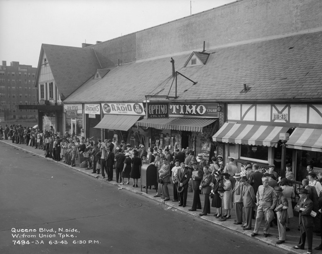
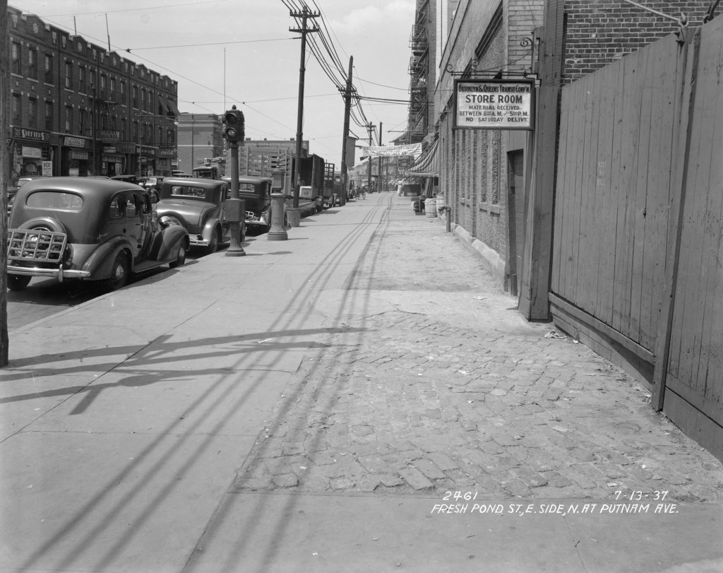
We again thank the NYC Municipal Archives for their help in making this happen. For more images like these, visit https://nycma.lunaimaging.com/luna/servlet.
* * *
If you have any remembrances or old photographs of “Our Neighborhood: The Way It Was” that you would like to share with our readers, please write to the Old Timer, c/o Ridgewood Times, 38-15 Bell Blvd., Bayside, NY 11361, or send an email to editorial@ridgewoodtimes.com. Any print photographs mailed to us will be carefully returned to you upon request.