By The TimesLedger
Bayside
Europeans lived and traded on the Alley, a creek that flowed south out of Little Neck Bay, as early as the 1630s. There was a small village that was later named Bayside by Judge Effingham Lawrence, Bayside’s leading citizen, in the 1820s.
The Lawrences had lived in the area since 1644 when William Lawrence was given a grant of land by the Dutch. The Lawrences occupied the land on what is now 221st Street for 13 generations.
Judge Lawrence started the Lawrence Family Cemetery in Bayside, a New York landmark, where he is buried. Like other New York businessmen Alexander Bell, a British merchant and shipowner, bought 300 acres in Bayside in 1824. By the 1880s some of the estates and farms were subdivided into lots and sold for housing. Show business discovered Bayside in the early 20th century and celebrities such as W.C. Field, Buster Keaton, Norma Tallmadge and Pearl White moved to the area. Most were eventually lured to California.
Little Neck
The Matinecocks, an Algonquin tribe, first settled this area, near Little Neck Bay. In 1663 the Dutch gave Little Neck and the current town of Douglaston to Thomas Hicks, Thomas Ellison and John Ellison. Richard Cornell inhabited the area later.
A Loyalist town during the American Revolution, Little Neck residents were often robbed by British and Hessian soldiers.
Poet Bloodgood H. Cutter was born in Little Neck in 1817, resided there and died there in the early 1900s.
Old House Landing Road, now known as Little Neck Parkway, burned down on May 31, 1865. Its location had allowed access to the water where oysters and clams could be harvested. Railroad service covered this area in 1866.
During the early 1900s Westmoreland, Marathon Park, Waverly Hill, Little Neck Hills and Douglaston Hills were incorporated into Little Neck by the Rickert-Finlay Company.
Whitestone
The first settlers arrived in Whitestone about the same time as in Flushing. But Whitestone, supposedly named for a light-colored rock offshore that served as a landmark for sailors, remained a sparsely populated farming area for centuries.
Francis Lewis, a rich New York merchant moved to Whitestone in the early 1760s. Elected to the Second Continental Congress, he signed the Declaration of Independence. His wife was thrown into a Manhattan jail by British troops sent to Whitestone to burn Lewis’s house.
Samuel Leggett, another New York businessman, founded the New York Gas Light Co. in 1823 and made his Whitestone home the first in the city to be lighted by gas.
John Locke, a Brooklyn tinware maker, bought Leggett’s house in the mid-1800s and moved his factory to Whitestone, where it employed more than 300 people. Locke also helped bring to Long Island Rail Road to Whitestone.
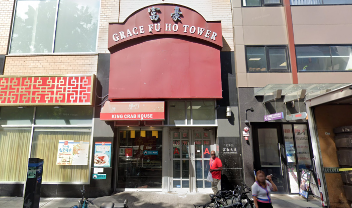
Flushing
Englishmen and women first settled Flushing in 1645, moving onto land that was controlled by the Dutch. English Quakers followed a few years later and Dutch governor Peter Stuyvesant persecuted them because of their religious beliefs.
The people of Flushing objected and signed a religious document called the Flushing Remonstrance, one of the first statements to defend religious freedom in the nation’s history.
Black Americans were brought to Flushing as slaves in the late 17th century and before long there was a growing free black population as Flushing’s Quakers began freeing their own slaves.
In the 1730s Robert Prince established the first commercial nursery in Flushing. The Irish began arriving in Flushing during the 1840s potato famine and by the turn of the century the area had become suburban. Rapid transit in the late 1920s changed Flushing dramatically.
Fresh Meadows
The Fresh Meadows apartment development was built without government aid of any kind as a social and profitable investment by the New York Life Insurance Company.
The company purchased the Fresh Meadows Golf Course, which opened in 1923, in the spring of 1946 and construction work began right away. The first 20 apartments were occupied in September 1947. The husband of each of the first families in Fresh Meadows had served in World War II.
New York Life kept control of the development, called “the finest example of large-scale community planning in the country” by social critic Lewis Mumford, until 1972.
The name “Fresh Meadows” can be seen on old 19th century maps at the Queens Historical Society. The name might have applied to this outer area of the old Flushing townships to distinguish it from the salt meadows found closer to the water.
Glen Oaks
Before World War II most of the land in Glen Oaks was still farmland, not much changed since colonial days when it was a remote area of Flushing township. In the 1920s part of the Vanderbilt estate was purchased by a group of wealthy golf enthusiasts and turned into the Glen Oaks Golf Club.
In 1944, the Gross-Morton real estate company purchased a 175- acre tract of land west of the golf course and began building two-story apartment buildings, with facades of red brick and white trim, in 1945. Gross-Morton borrowed the golf course’s name and called its development Glen Oaks Village.
The pioneers of Glen Oaks were nearly all veterans of World War II, newly married and recent migrants from the Bronx, Manhattan and western Queens.
In 1971, over the protests of many local residents, the Glen Oaks Golf Club was finally taken over by developers. Three 32-story buildings, the North Shore Towers, were built over the scenic views that originally inspired the name “Glen Oaks.”
Queens Village
During the colonial era the farmland area that is now Queens Village was called “Little Plain” to differentiate it from “Great Plain” in Hempstead.
Around 1837 the name was changed to “Brushville” to honor its founder, Thomas Brush, who had built stores, a church and tobacco curing factory along Hempstead Turnpike. The Long Island Rail Road spurred growth by opening a stop at Brushville.
By 1856 the citizens had begun informally calling the town “Queens Village” and the name stuck. Right after the Civil War Scott Sherwood set off a housing boom when he auctioned off 300 acres of land he had inherited in Queens Village.
A financial depression in 1873 halted the building frenzy, but the 1920s brought a new round of home building that created much of the community that exists today. The LIRR formally changed the name of its Brushville station to Queens Village in 1924.
Jamaica
The Dutch chartered the town in 1656 and called in “Rustdoff,” but the primarily English settlers who came from Hempstead preferred the name “Jamaica.” The name was derived either from an Indian word for beaver or from the name of a local tribal group.
Jamaica Avenue, originally part of an Indian trial, became part of what was known as “Ferry Road” because it ran from Hempstead to the ferry in Brooklyn. British troops occupied Jamaica in the Revolution and used it as a command center.
Rufus King, a U.S. senator, ambassador to Britain and presidential candidate, lived at King Manor. Jamaica’s black community dates back to at least the 1770s. Blacks in Jamaica helped introduce a bill in the state Legislature that banned segregation in schools in 1900.
Laurelton
Until the early 20th century the area now known as Laurelton was considered part of the Jamaica township. Abundant water nourished farmland and was part of the supply system for the city of Brooklyn in the 19th century from site that is now Brookville Park.
In 1905 the Laurelton Land Company purchased some farms in the area and the venture’s president. Sen. William Reynolds, touted the access that the new Long Island Rail Road station would provide.
In 1923 the Laurelton Golf Course was built, but in 1928 the property was acquired by Laurel Homes Inc. “for low-cost housing that had a stamp of individuality.” The detached Spanish-style homes had six rooms and sold for $6,900.
In the 1920s Jewish, Irish, Italian and German families moved into Laurelton and were followed by blacks in the 1940s.
Forest Hills
The original name for Forest Hills was “Whitpot,” which may have been from a Dutch word meaning dry stream bed. There were a number of farmhouses and a successful farm owned by German-born Ascan Backus around 1820.
In 1904 Cord Meyer, who had developed modern Elmhurst, bought 500 acres, including most of the Backus farm. He changed the name from “Whitpot” to Forest Park because the land bordered the new Forest Park.
The first homes were built on what used to be called Roman Street and sold at $5,600 each, while the second group was on Queens Boulevard with a pricetag of $6,500 each. Meyer persuaded the Long Island Rail Road to build a temporary stop near Austin Street.
In 1910 he sold his land south of the LIRR tracks to the Russell Sage Foundation, which built the planned community of Forest Hills Gardens. Cord Meyer Corp. still is headquartered in Forest Hills.
Astoria
Fur salesman Stephen Alling Halsey began developing Astoria in 1839, naming the town after the fur trader John Jacob Astor. Astoria was built around a ferry terminal at the edge of Astoria Boulevard, and eventually expanded.
In 1840 St. George’s Episcopal Church, Astoria’s oldest building, was built as an all girls school. It became a parish hall because of a lack of funding and was moved in 1903 for St. George’s Church.
Astoria was the site of various homes and businesses including mansions, a town built by the German United Cabinet Workers in 1869, Schuetzen Park in 1870, a village and factories built by piano maker William Steinway, six-family homes and in the mid-1920s, the Norwood Gardens community.
The city was made more accessible by the Independent subway along Steinway Street and Broadway on Aug. 19, 1933, and the Triborough Bridge to Manhattan and the Bronx on July 11, 1936. The ferry was discontinued on Aug. 1, 1936 with the opening of the bridge.
The Famous Players-Lasky Corporation (Paramount) opened the Astoria Studio in 1920. The studio underwent a number of ownership and name changes as the production site of various media including films, commercials, wartime movies and Army training films. The Astoria Studio was called Eastern Studios Inc. after Western Electric enabled it to make movies with sound in 1929. The studio was abandoned in 1971 and reopened in 1975.
A nearby building holds the American Museum of the Moving Image.
Expansion of Astoria Boulevard in 1934 made room for the Grand Central Parkway.
Ridgewood
Once home to the Mespachtes Indians and later part of the Wyckoff and Debevoise farms, Ridgewood was settled in the late 1800s when workers came to the area to build caravans for street-railway companies.
Even more settlers came in 1889 when the Myrtle Avenue el was built there.
Ridgewood’s only surviving Dutch farmhouse is the Adrien Onderdonck House, which was built in 1731.
Named Ridgewood for its wooded terrain, the area was often called Evergreen from the late 1880s until the end of World War I because a town on Long Island said it had priority on the name Ridgewood.
The middle-class, German population of Ridgewood found homes in small frame houses and, later, in Mathews Flats, a complex of nearly 1,000 six-family brick row houses built by Gustav Mathews in 1906. Builder Paul Stier built another complex between 67th and 70th avenues from 1908-1914.
The largely middle-class community has a strong German heritage, but is also now home to a variety of cultures, including Yugolsavs, Romanians, Puerto Ricans, blacks, Polish, Chinese, Dominicans, Italians, Koreans and Ecuadorians.
Richmond Hill
Albon P. Man, a wealthy Manhattan lawyer, hired landscape architect Edward Richmond to develop what was largely farmland into a planned community in 1867.
The community took shape over the next seven years and was incorporated as Richmond Hill in 1894. Most of its residents were wealthy Manhattan businessmen who built large homes on even large plots of land.
Development was rapid and by 1920 there was no open land left.
Richmond Hill was largely settled by German and Irish people but later became home to a diverse population, including Guyanese, Latin Americans, Dominicans, Ecuadorians, Indians and Jamaicans.
Today many of the elegant homes from the turn of the century still stand and Richmond Hill remains a well-maintained residential neighborhood.
Howard Beach
William J. Howard transformed what was known as Ramblersville from creeks and shacks on stilts into a resort, then a residential area. He raised goats, then began dredging, filling marshy areas and other improvements. The resulting area of waterways somewhat resembled Venice.
From these early beginnings evolved the Howard Beach of today, a pleasant and compact residential community 25 blocks wide and nine blocks long bordered by the Belt Parkway on the north, Spring Creek Park on the west, JFK airport on the east and Jamaica Bay on the South. Cross Bay Boulevard, Howard Beach’s principal commercial street, is replete with diners, clam bars and malls.
Many Howard Beach residents point out the seaside country-in-the-city atmosphere of their community as the reason they live there.