By Naeisha Rose
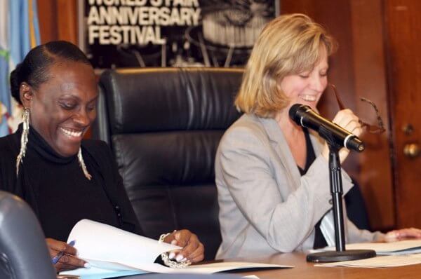
Borough President Melinda Katz and Deputy Borough President Melva Miller were joined by Queens community board members to discuss the citywide overview plans on flood resiliency Monday.
Leading the discussion at Queens Borough Hall was Department of City Planning Director John Young and Resiliency Planner Melissa Herlitz.
Young and Herlitz both presented zoning and land-use strategies that can be used now and in the future to reduce flood risks for communities throughout the floodplain.
Of the 14 community boards in Queens, only Community Board 9, which covers Richmond Hill, Woodhaven, Kew Gardens and Ozone Park, does not have a part touching a floodplain zone.
The purpose of the meeting was to present adaptive planning and to stimulate rebuilding by creating homes and multi-family units that will be durable during climate-related events, such as elevated water levels based on projected flood damage all the way to 2050.
If implemented, these plans could protect homeowners from skyrocketing flood insurance premiums that could go up to as much as $9,000 a year, Houses that are elevated to sustain the projected flood damage would have insurance premiums under $500, according to Herlitz.
“No longer can we look at the oceans, the rivers, the bays that surround the city’s edges for merely recreational or commercial transportation purposes,” Young said. “They actually pose a serious flood threat to the city’s existence.”
New York City’s 520 miles of coastline lack a robust natural defense, “so a range of strategies will be needed to respond to flood threats,” the director said, pointing out “161 miles, or more than 30 percent of the city’s coastline, is on Queens’ shores. This issue has a primary need to be considered by the borough’s residents.”
This includes the part of Queen’s geography that falls along the East River, all of Jamaica Bay and the Atlantic Ocean. Herlitz made suggestions to help protect homes.
“We identified six areas that we think we can improve,” Herlitz said.
Her suggestions included cementing over basements, adding an extra story to home designs, and elevating homes to three feet above flood elevation. She also called for the rebuilding of damaged homes in areas with restrictive zoning, expanding the Build-it-Back program for bungalow-styled homes and homes in small lots that was introduced after Hurricane Sandy, and limiting density in highly vulnerable areas.
These potential recommendations were created after the onslaught of Sandy. They also were developed amid projection that NYC sea levels are expected to rise by eight to 30 inches buy the 2050s and as high as 75 inches by the end of the century, according to the NYC Panel on Climate Change.
If no action is taken by then, 400,000 residents, 291,000 jobs and 72,000 buildings are at risk of severe flood damage citywide, according to a flood risk brief that goes back to November 2016 from the Department of City Planning.
For homeowners, that means there will be a 26 percent chance of flooding in the life of a 30-year mortgage citywide.
Many homeowners who are a part of the Build-it-Back program, an initiative that helps residents fix their homes for free, don’t want to lose their cellar space. Others who can afford to build or rebuild their homes don’t want to incur the price tag that comes with elevating a home or the modifications.
“People are not going to give up half their house to elevate, move the mechanicals and do all the things that they need to do because it is going to be costly,” CB 10 Chairwoman Betty Braton said. “We’ve got to find a way to make it financially viable.”
Herlitz acknowledged the importance of the loss of space and the costs for homeowners that don’t fall under the Build-it-Back program. She is consulting with the mayor’s office to address this issue.
Reach reporter Naeisha Rose by e-mail at nrose