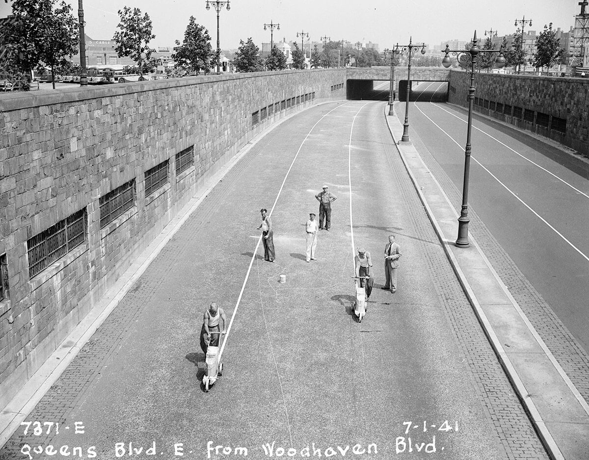
We’re certain many of our readers are familiar with the Queens Boulevard “freeway” through Elmhurst and Rego Park, a short highway that runs under Woodhaven Boulevard and the Long Island Expressway.
The viaduct passes Queens Center Mall, one of the busiest shopping centers in America and, most certainly, the most active mall in Queens. But did you know that, at one point in time, the city planned on converting Queens Boulevard into one of the borough’s first expressways?
According to historians, the New York City Planning Department began efforts in 1941 to construct what was called the Queens Boulevard Express Highway, covering eight miles from the Queensboro Bridge to Hillside Avenue. In the age of the automobile, city planners saw the conversion as important to keeping the city moving.
The plans would have included closing off access to the boulevard from most side streets and lowering the roadway at important intersections. The city constructed the freeway in 1941 below Woodhaven Boulevard and what was then Horace Harding Boulevard, and had planned on building similar freeways for the length of the “Express Highway.”
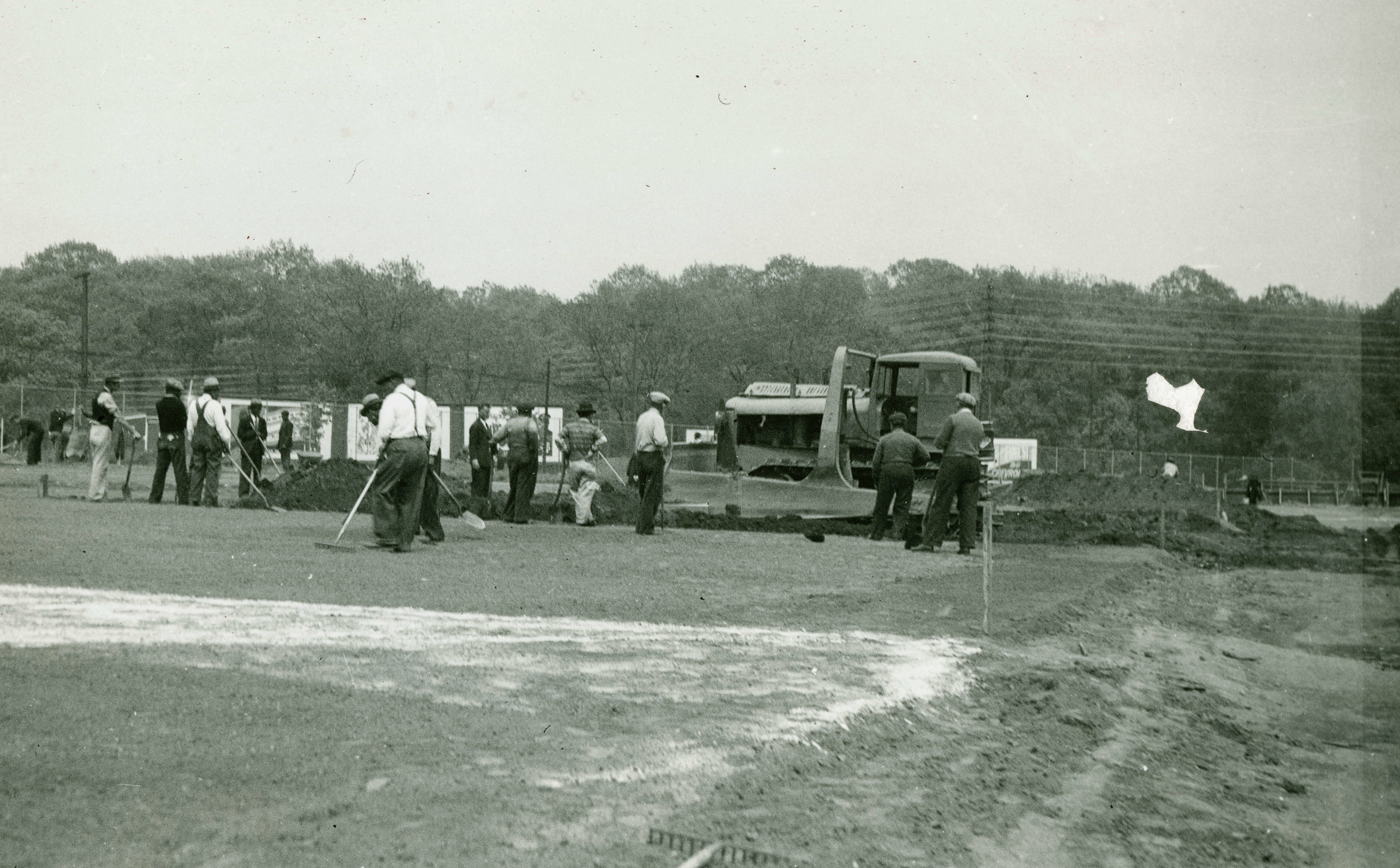
The freeway opened in 1941, and the image at the top of this story shows crews painting solid white lines along three of the six lanes. But the highway was never completed, as the project was scrapped once the United States entered World War II, and resources were devoted to the war effort.
Of course, Queens would see several expressways constructed in the years after World War II ended. Master planner Robert Moses would construct the Long Island Expressway beginning the 1950s from the Queens Midtown Tunnel to Riverhead, Long Island. Much of the route in Queens would be built along Horace Harding Boulevard.
The Queens Boulevard freeway photo is just one of the hundreds of thousands of photos in the New York City Municipal Archives. We’re fortunate to share many more images from the archives with you in this week’s column.
For more historical images of Queens and the other boroughs, visit https://nycma.lunaimaging.com/luna/servlet.
* * *
If you have any remembrances or old photographs of “Our Neighborhood: The Way It Was” that you would like to share with our readers, please write to the Old Timer, c/o Ridgewood Times, 38-15 Bell Blvd., Bayside, NY 11361, or send an email to editorial@ridgewoodtimes.com. Any print photographs mailed to us will be carefully returned to you upon request.