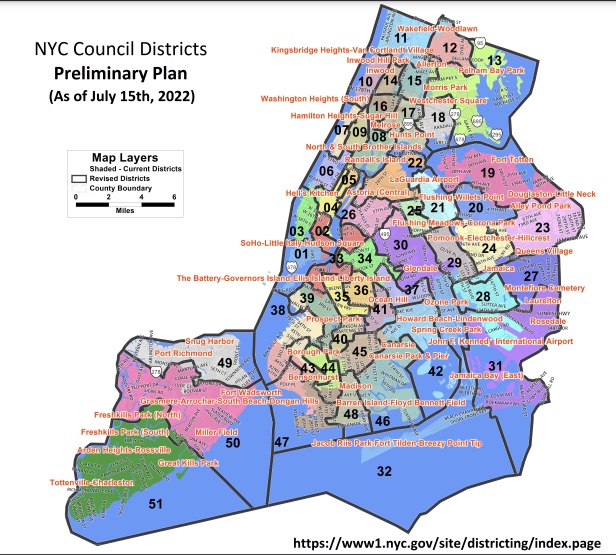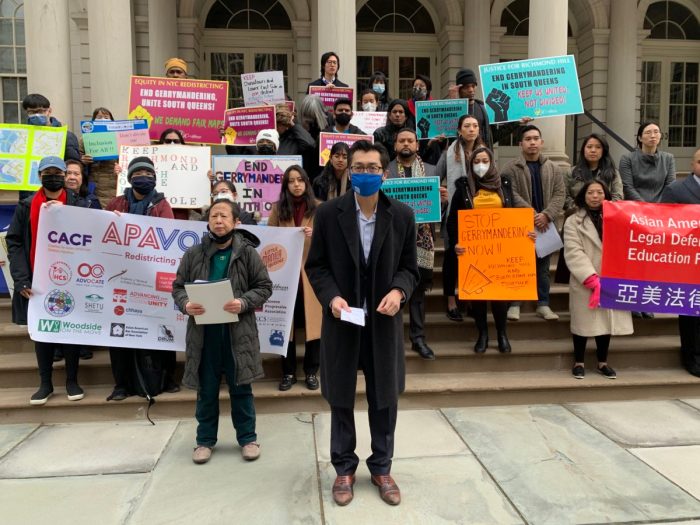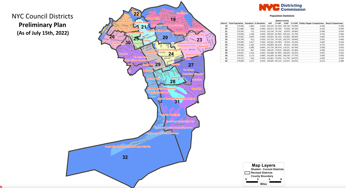
The New York City Districting Commission is facing backlash from Queens leaders after releasing a preliminary map of redrawn City Council districts last week, with some officials saying that the new lines would not accurately represent the communities they serve.
The commission emphasized that this is the first draft, but it is also a major step toward updating the new district maps since the 2020 Census was taken.
In western Queens, City Council member Julie Won’s newly drawn District 26 would be stripped of Sunnyside and much of the waterfront area in Astoria and Long Island City. With the new map, Won would represent Roosevelt Island and a sliver of the Upper East Side of Manhattan.
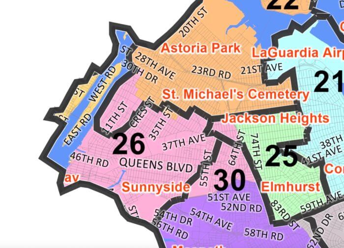
Won told QNS she is extremely unhappy with these changes, saying it even violates the City Charter, which states says that “district lines shall keep intact neighborhoods and communities with established ties of common interest and association, whether historical, racial, economic, ethnic, religious or other.”
“The commission chose to separate our communities of color in Long Island City, while also disenfranchising our immigrant communities by splitting Woodside into four council districts,” Won said.
Won mentioned that though it is an honor to represent any New Yorker despite their ZIP code, she plans to protest these proposed maps.
“I cannot stay silent while the districting commission erases the progress made by immigrants and people of color in my own neighborhood,” Won said. “Members of the Districting Commission must be held accountable for violating every single requirement mandated by the City Charter. In the coming days, I will engage with all communities in my district to make our voices heard, and we will take this fight head-on.”
Further into Queens, John Choe, the executive director of the Greater Flushing Chamber of Commerce, criticized the commission for splitting up the neighborhood of Mitchell-Linden.
Currently, Mitchell-Linden is represented in the 20th District, however, the new map would split the neighborhood in half, making the northern portion part of the 19th District — which includes College Point, Bayside, Little Neck, Douglaston and other parts of Flushing.
Choe, who lives in southern Mitchell-Linden, said that dividing the neighborhood would dilute the voices of the community.
“It doesn’t make any sense; we deserve to be made whole and to articulate our needs as one community,” Choe said. “Our needs are similar and distinct from the surrounding areas in Flushing. Our voices will be diluted; our requests will fall on deaf ears because we would have to deal with two separate council members.”
A new map is drawn every 10 years following the U.S. Census. The city’s population grew from 8.2 million people in 2010 to 8.8 million people in 2020. In order to reflect this increase, the city’s new map raises the average number of residents per district from 160,710 to 172,882.
The districting commission heard public testimony from nearly 500 city residents in each borough before deciding on this map. Now, the commission will host an additional set of hearings, giving the community an opportunity to voice their concerns.
Hearings are scheduled for Aug. 15, 16, 17, 18 and 22. Testimony can also be submitted via email at publictestimony@redistricting.nyc.gov and by mail to 235 Broadway, NY, NY 10007.