The second part of our look at Forest Park’s history focuses on the timeless Forest Park Carousel and other important cultural and athletic venues. We’ll also take a look at the construction of a roadway that not only dissected the park itself, but also had grave implications on a nearby cemetery and future commuters.

In 1918, the Forest Park Carousel was built by William H. Dentzel of Philadelphia, in the plant started by his father, Gustave, in 1868. The horses, lions and simulated leather saddles were hand carved by Daniel Muller, one of the greatest of the master carousel carvers.
If you sat on one of the outside horses, you could reach for the metal ring that was held by a wooden arm. If you were lucky to get the brass ring, you were entitled to a free ride.
“Tony” was considered the best mount. It was a black horse that moved up and down and had a canteen and pistol. The other horses that moved up and down were also desirable, while the stationary horses were not highly regarded by the children. The swan cart was used only by grandmothers holding infants.

A fire destroyed the original Forest Park Carousel in 1966, and was replaced in the 1970s with a Muller merry-go-round formerly used at the defunct Lakeview amusement park in Dracut, Mass. It is one of only two Muller carousels still operating in the U.S.; the other is located at Cedar Point Amusement Park in Sandusky, Ohio.
The carousel operated continuously until 2008, save for a brief period during the late 1980s when it was closed for renovation. In 2008, the Parks Department shut the ride down after it failed to reach an agreement with its previous operator.
The beloved ride would remain closed for four years until the city Parks Department selected a new operator. To the delight of children of all ages, the Forest Park Carousel began spinning again in 2012, with New York Carousel Entertainment operating the ride on the Parks Department’s behalf.

And it figures that generations of children will get to enjoy the Forest Park Carousel for decades to come, as the city Landmarks Preservation Commission granted it landmark status last year.
A place to play & remember
In 1924, the City of New York acquired by condemnation two acres and a house located on the south side of Myrtle Avenue and 80th Street. Eventually, the third and second stories were removed and the sides were cementcoated. This became the comfort station for Dry Harbor Playground.
Why did they call it Dry Harbor when the nearest waterway is miles away? It is said that the early settlers who came to the area in the 1700s, while standing on higher ground, described the homes in the lowlying area between Cooper Avenue and the hills in what became Forest Park as resembling ships in a harbor without water.
The Dry Harbor name stuck until about 1869, when local residents changed their community’s name to Glendale. Nonetheless, Dry Harbor Playground—and Dry Harbor Road, located in nearby Middle Village—remain as reminders of the area’s original brand.
According to the city’s Parks Department, Dry Harbor Playground opened in 1934 and included swings, seesaws, a wavy slide, a flag pole and a schoolyard gymnasium. Renovations in the years that followed brought new amenities including basketball courts, a sprinkler area, a shuffleboard court and a baseball field.
In recent years, Dry Harbor Playground took on a greater significance, as it is the location of a memorial garden dedicated to local victims of the Sept. 11, 2001 terrorist attacks on the World Trade Center.
The American Day Parade Committee—which organized a memorial march through Glendale in 2002, for the first anniversary of the attacks— sought to build the monument in honor of 42 victims from Glendale and the surrounding communities of Ridgewood, Middle Village and Woodhaven.
Initially, the Parks Department bucked at the idea of having a monument within the memorial garden, but after much public pressure from the committee, local elected officials and civic activists, the agency agreed to the memorial in February 2007.
Track and bandshell
Victory Field opened on Apr. 27, 1927, at the corner of Woodhaven Boulevard and Myrtle Avenue. It was dedicated to the veterans of World War I and had six baseball diamonds, a quarter-mile cinder track and several handball courts. In the winter, the track infield was flooded for ice skating. In the fall, several of the fields were used for football and soccer.
Used by athletes of all kinds through the years, Victory Field was renamed in honor of former Assemblyman and Judge Frederick Schmidt in April 2007. The renaming coincided with the completion of a multi-million dollar renovation of the facility.
Forest Park also boasts the George Seuffert Bandshell, constructed in 1920. It is named for George Seuffert Sr., a music teacher and concert violinist who went on to become the popular leader of the Concordia Military Band, later renamed the Seuffert Band.
For years, the Seuffert Band played to parkgoers atop a bandstand where the bandshell is now located. Seuffert continued leading performances before thousands of people after the bandshell’s completion in 1920; ultimately, he would pass the baton to his son, George Jr., who kept the Seuffert Band performing for decades to come.
Renovated twice in 1977 and 1999, the Seuffert Bandshell accommodates up to 3,500 people and annually hosts a wide variety of free concerts each summer, including performances by the Queens Symphony Orchestra.
A road runs through it
In 1912, talk started about building a roadway 150’-wide through Forest Park from Highland Park, with the road to cut also through Cypress Hills Cemetery. However, there were objections and nothing came of it.
For years, the only road through Forest Park was the eponymous Drive, designed by Frederick Law Olmstead, the famed architect best known for designing Central Park.
Forest Park Drive winds its way from Myrtle Avenue in Glendale to Park Lane near Union Turnpike on the Forest Hills/Kew Gardens border. Two segments are open to vehicular traffic today: one between Myrtle Avenue and Woodhaven Boulevard, and the other between Park Lane and Metropolitan Avenue. The segment between Woodhaven Boulevard and Metropolitan Avenue is reserved for bicyclists and pedestrians.
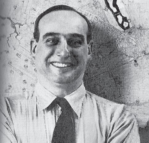
But in the 1930s, master builder Robert Moses succeeded in constructing the Interboro Parkway through both Forest and Highland Park and Cypress Hills Cemetery, linking the Grand Central Parkway in central Queens to Highland Boulevard and Jamaica Avenue in Brooklyn.
The road was a branch of Moses’ parkway system, built at a time when driving was more of a leisure activity than a routine. The “ribbon parks,” as they were called, were lined with trees and featured slopes and curves to give drivers and passengers an enjoyable scenic experience while motoring.
During his more than 40 years in city and state government, Moses developed a reputation of letting almost nothing stand in the way of his vision. If he wanted a road built, he was going to build that road regardless of the obstacle—including landmarks, parkland, homes and people.
In the case of the Interboro Parkway, many graves laid in Moses’ way—but not for very long. His parkway carved a long, winding path through the heart of Cypress Hills Cemetery. Thus, it was necessary to dig up and removed hundreds of caskets and relocate them. A large number of laborers were used to perform this grim task.
A number of the old picnic parks were also torn down by the construction of the parkway, including Banzer’s Cypress Hills Park at Cypress Avenue and Cypress Hills Street; Florids Park, on the southwest corner of Myrtle Avenue and 88th Place; and Sportland (a.k.a. Glendale Schuetzen Park) on the north side of Myrtle Avenue adjacent to 88th Place.
The buildings were torn down in August 1933, and the parkway’s construction reduced Forest Park’s acreage from 534 to 508 .
The Interboro Parkway opened in 1935, but within six years’ time, city planners recognized the parkway’s dangerous curves. A 1941 New York City Planning Department report declared, “At two points in the parkway, there are bad curves that are a serious hazard and impair the usefulness of the parkway. While realignment would be difficult because the parkway passes through cemeteries, it is nevertheless urgently necessary.”
The Interboro was renovated from time to time in the decades that followed, and speed limits and lane restrictions were instituted along the curves to keep drivers safe. That has not, however, entirely eliminated accidents along the stretch—nor the ensuing traffic jams and rubbernecking.
Good news for the Interboro came with a new name in 1997, as the city declared it the Jackie Robinson Parkway, honoring the great Brooklyn Dodger second baseman who broke baseball’s color barrier 50 years earlier.
If you have any remembrances or old photographs of Our Neighborhood that you would like to share with our readers, please write to the Old Timer, c/o Times Newsweekly, P.O. Box 863299, Ridgewood, NY 11386, or send an email to neighborhood@timesnewsweekly.com. Any print photographs mailed to us will be carefully returned to you.


