By Gina Martinez
The lack of changes in the Flushing Waterfront Revitalization plan has frustrated members of Community Board 7’s Land Use Committee who are concerned about flooding and bringing more residents into an already teeming neighborhood.
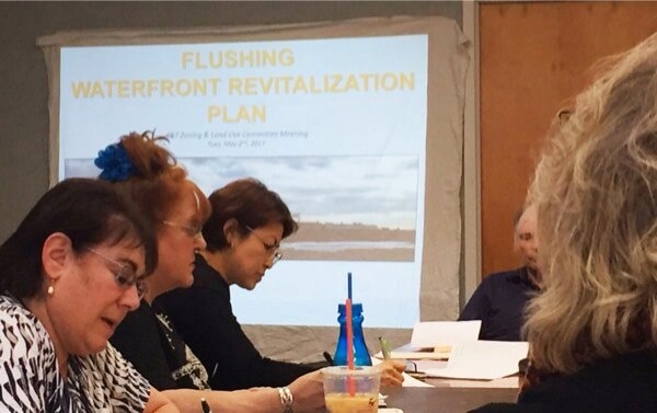
The Department of City Planning held a presentation, led by Queens Director John Young, Tuesday on the waterfront plan. But committee members raised some concerns, including flood resiliency, infrastructure and overcapacity.
In 2011, the Flushing-Willets Point-Corona Local Development Corporation received a $1.5 million state Brownfield Opportunity Grant to fund the project, which would clean up and rezone 60 acres on the Flushing waterfront and create a planned community with waterfront access as well as housing and commercial space.
The 32-acre study area runs from Prince Street to Flushing Creek on the west, Roosevelt Avenue on the south and Northern Boulevard on the north. Three-quarters of the area is zoned C4-2 for a commercial and residential zone. The northern part of the area has M1-1 zoning for light manufacturing, while the part along the waterfront is zoned M3-1 for heavier manufacturing.
Following the presentation, board member James Cervino, an environmental scientist, raised the question of protection against flooding. He asked how developers were going to address the coastal zone erosion line that he said would be flooded and underwater in 50 years. Cervino called it a major problem. He also wanted to know about plans for evacuation in case of a flood.
“Northern Boulevard is so dense, how are you going to evacuate those people?” Cervino asked. “Is there an emergency contingency plan regarding flooding? We’re already at capacity. How are you going to deal with evacuating people? I would love to see something green happen, but putting development in that spot is too dangerous.”
A representative from City Planning said that precautions were being taken, but the potential for flooding does not mean developers should avoid the area completely.
“Just because an area is vulnerable to flooding doesn’t necessarily mean we should retreat from that area,” she said. “We can design our buildings to be more resilient, elevated above flood plain, elevate mechanical systems so that after a storm maybe there’s a little bit of damage to the building, but people can move back in quickly.”
Joe Sweeney, the Land Use Committee’s chairman, was upset that the presentation featured very few differences from the city’s last plan and that the changes did not reflect the community’s desires.
“You said you listened the community,” he said. “I went to some of these meetings and you know I’m not sure if you really listened to the community. We asked you to look into the 7 train, that’s at 125 percent overcapacity. That was not addressed tonight. The schools in the area, they’re at overcapacity. Now you plan to put this in and shove more kids into these schools? You also have the traffic on College Point Boulevard. It’s jammed, you can’t get up and down. It has not been addressed tonight. How can you commit to a community if you don’t address their concerns? You’re going to destroy what they’ve built. People are going to move out.”
Sweeney said the committee will not approve the development plan until it meets their concerns.
Reach Gina Martinez by e-mail at gmart


