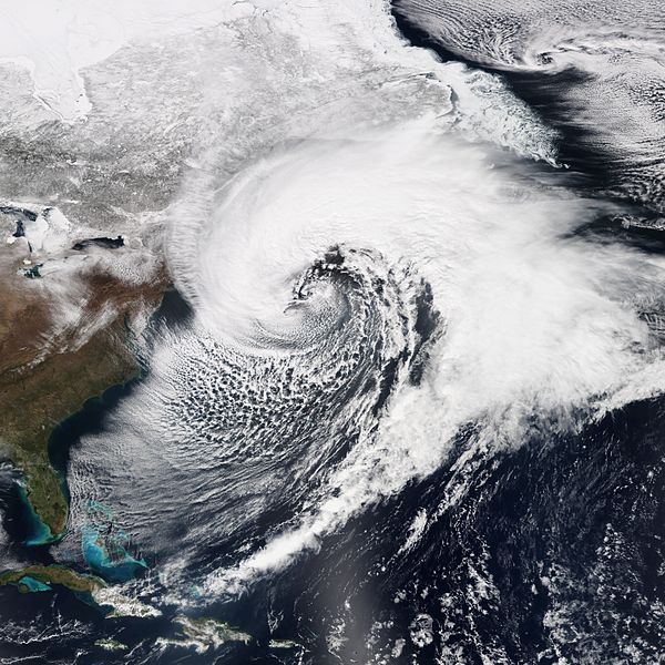
Another “bomb” of a winter storm is heading for the northeast coast, and Queens could get some heavy rain, wind and coastal flooding starting tonight and through the weekend.
A jet stream that is currently making its way through the Midwest will lose pressure as it heads towards the east coast, turning the storm into a “bomb cyclone,” also known as an explosive cyclogenesis or a bombogenesis. The nor’easter will begin Thursday night and continue into Friday.
According to the National Weather Service, Queens can expect rain to start after 7 p.m. tonight. Winds will pick up to 8 to 16 miles per hour and the temperature could reach a low of 37 degrees. By Friday morning, there is a 100 percent chance of precipitation. The temperature will fall to around 35 degrees by 2 p.m. with wind chill values between 20 and 30 degrees. Wind speeds will increase from 15 to 20 miles per hour to 28 to 33 miles per hour in the afternoon and winds could gust as high as 55 miles per hour.
Friday night will bring periods of rain and snow before midnight. The temperature could reach a low around 35 degrees and wind chill values could between 20 and 25 degrees. The wind will reach speeds of 31 to 34 miles per hour, with gusts as high as 55 miles per hour. New snow accumulation of less than a half inch is possible.
On Saturday morning, there is a 40 percent chance of rain and snow before 11 a.m., followed by a chance of rain between 11 a.m. and 1 p.m. Winds will reach 22 to 28 miles per hour, with gusts as high as 46 miles per hour.
Saturday night is expected to be mostly cloudy with a low of 36 degrees. Sunday will be mostly sunny with a high around 45 degrees.
The National Weather Service issued a High Wind Watch for Friday afternoon and night. The damaging winds and wet snow could cause trees and power lines to fall, causing possible outages throughout the city and Long Island.
A Flood Watch has also been issued for vulnerable locations along the shorelines of Southern Queens. The advisory will be in effect from early Friday morning to late Friday night.