Glendale’s 88th Street was originally named Van Dine Avenue in recognition of the family that owned the land in the area. Today, it’s considered the backbone of eastern Glendale.
Their name originally was spelled Van Duyn. The founder of the family in America was Gerrit Cornelisz Van Duyn, a Hugenot from Burgundy, France, who fled to Zwol, Holland. From there, he emigrated to America in 1649, a time when New York was the Dutch colony of New Amsterdam. Upon arriving in the New World, he settled in Brooklyn.
In 1719, his grandson, William Van Duyn, 26, purchased a farm of an estimated 350 acres in an area then known as the Hempstead Swamp. The approximate boundaries, as measured by present day roads, were Woodhaven Boulevard on the east; 84th Street on the west; Juniper Valley Road on the north; Union Turnpike on the southeast; and Myrtle Avenue on the southwest.
For five years, William Van Duyn and his wife lived in the house that was on the farm when he bought it. In 1724, he built a new, larger house on the west side of what was then called South Meadow Road (present-day Woodhaven Boulevard), just north of what later became Cooper Avenue.
William Van Duyn and his wife had two sons: Cornelius, born in 1724, and Dow, born in 1730.
In 1752, Cornelius Van Duyn, then 28 married Anna Vanderveer, daughter of Dominicus Vanderveer, a neighboring farmer. After getting married, Cornelius built a house on the west side of South Meadow Road, just south of what would become Cooper Avenue.
In about 1756, Dow got married and built a house on the west side of the South Meadow Road, several hundred yards north of what is today Metropolitan Avenue.
Cooper Avenue, at this point, didn’t exist. It was not until 1800 when the roadway was constructed as a wagon path from the present-day intersection of Cooper Avenue and Cypress Hills Street to what was then South Meadow Road.
Once the road was built, it effectively became the dividing line between the Van Duyn farms.
But long before Cooper Avenue came into being, one of the Van Duyn sons found himself in a rivalry with a neighboring farm family during the American Revolution.
The world turned upside down
By 1775, farmers across the area began taking sides in the conflict. Some were patriots standing with the cause of American independence; others were loyalists seeking to remain subjects to King George III of England.
While Dow Van Duyn was a staunch loyalist, his neighbor on the eastern side of South Meadow Road — the family of Jeromus Remsen Sr. — were patriots who had several family members fighting in the local militia.
Following the Battle of Long Island on Aug. 27 and 28, 1776, in Brooklyn, British Army members began scouring the Hempstead Swamp area looking for rebels. They were aided by loyalists who acted as informers against their patriot neighbors.
One loyalist led the British soldiers to the Remsen farm, where Garret Remsen, who had fought at the Battle of Long Island, had returned to following the Continental Army’s defeat there. Garret Remsen, however, was awakened by his family and fled out the back door before the advancing British Army could get him.
The next day, Aert Van Duyn, believed to be a son of Dow Van Duyn, took horses from Jeromus Remsen’s meadow and gave them to the British soldiers. This act, of course, intensified the bitter feelings between the Remsen and Van Duyn families.
Of course, the Continental Army would win American independence from the British following the Battle of Yorktown in 1781. Three years later, in 1784, a commission of forfeiture was established to judge whether the lands of remaining British loyalists should be seized because of their actions during the American Revolution.
The only farm in Queens seized from a loyalist family turned out to be the 200-acre Dow Van Duyn farm. It was sold at a public auction to New York City merchant Thomas McFarren. It’s believed that the Van Duyn family changed the spelling of their name to Van Dine in the wake of the scandal.
Changing hands toward progress
The former Dow Van Duyn farm would change several times over the next few decades.
Meanwhile, descendants of Cornelius Van Duyn kept the family farm together, and over the next 50 years, the Van Dine family would buy nearby parcels of land in the present-day Glendale area, including some of the former Dow Van Duyn farm. By 1832, Garret Van Dine owned 150 ½ acres of land in the Glendale area.
Garret Van Dine died in 1857, and directed in his will that his estate be sold, with the proceeds divided among his brothers, sisters and other relatives. His executors, however, decided not sell everything in one parcel, choosing instead to divide it into 16 lots which were sold on July 27, 1860, for a total of $35,483.
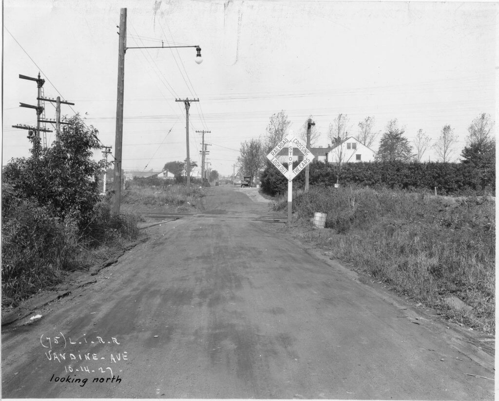
Because each parcel had to have access to a public road, the surveyor that the executors hired laid out a road running north and south through the property, and called it Van Dine Avenue.
Some of the land south of Cooper Avenue was sold to farmers and later to the Catholic Church for the creation of St. John Cemetery. Other parcels of land were sold and resold over the next 40 years to farm families in the community.
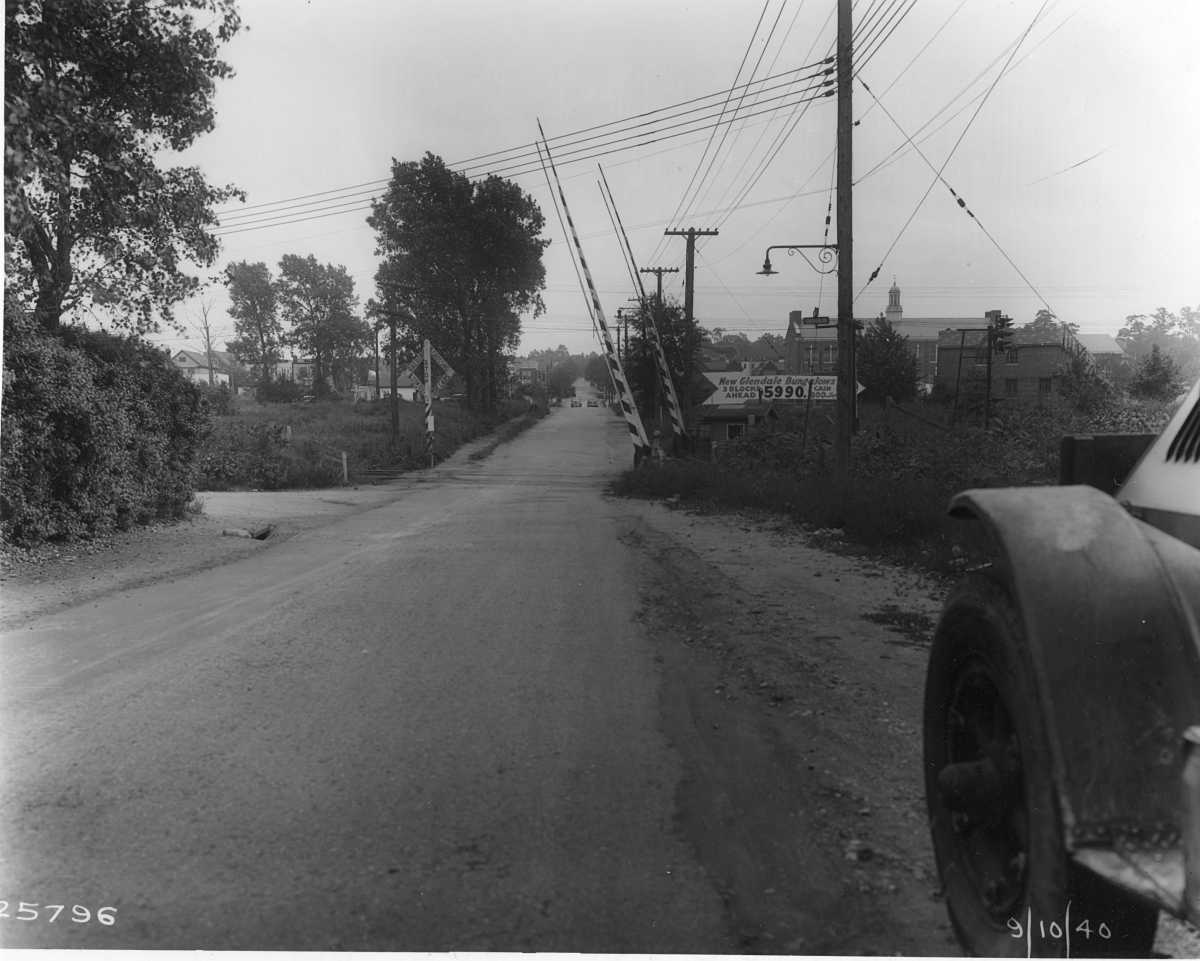
In the early 1890s, the Long Island Rail Road installed crossing gates at Van Dine Avenue, and hired a watchman to raise and lower them as the trains passed. This crossing is still there today and is used by trains running on the LIRR’s Lower Montauk Branch.
It’s one of only two at-grade railroad crossings in the Glendale area. The other is at the corner of Edsall Avenue and 73rd Street, near the now-closed Glendale station.
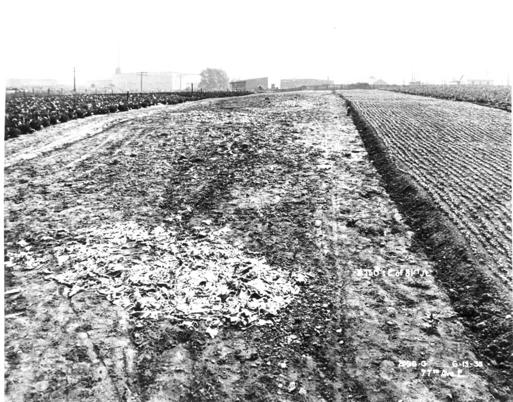
During the early 1900s, most of the farm land was sold to developers, and the community evolved from a rural landscape into an industrial and residential neighborhood.
For instance, in 1923, the Asco Supply Company, which handled concrete pipe and did sheet metal work, occupied 4 ½ acres on Van Dine Avenue between Cooper Avenue and the Long Island Rail Road, employing 50 men.
In June 1923, Charles J. Hettesheimer was selling building lots on Doran Street (now 72nd Avenue) and Delia Street (now 84th Street), adjacent to Van Dine and Cooper Avenue. John J. Kessel and Caroline Drentalau were also offering building lots on the west side of Van Dine Avenue.
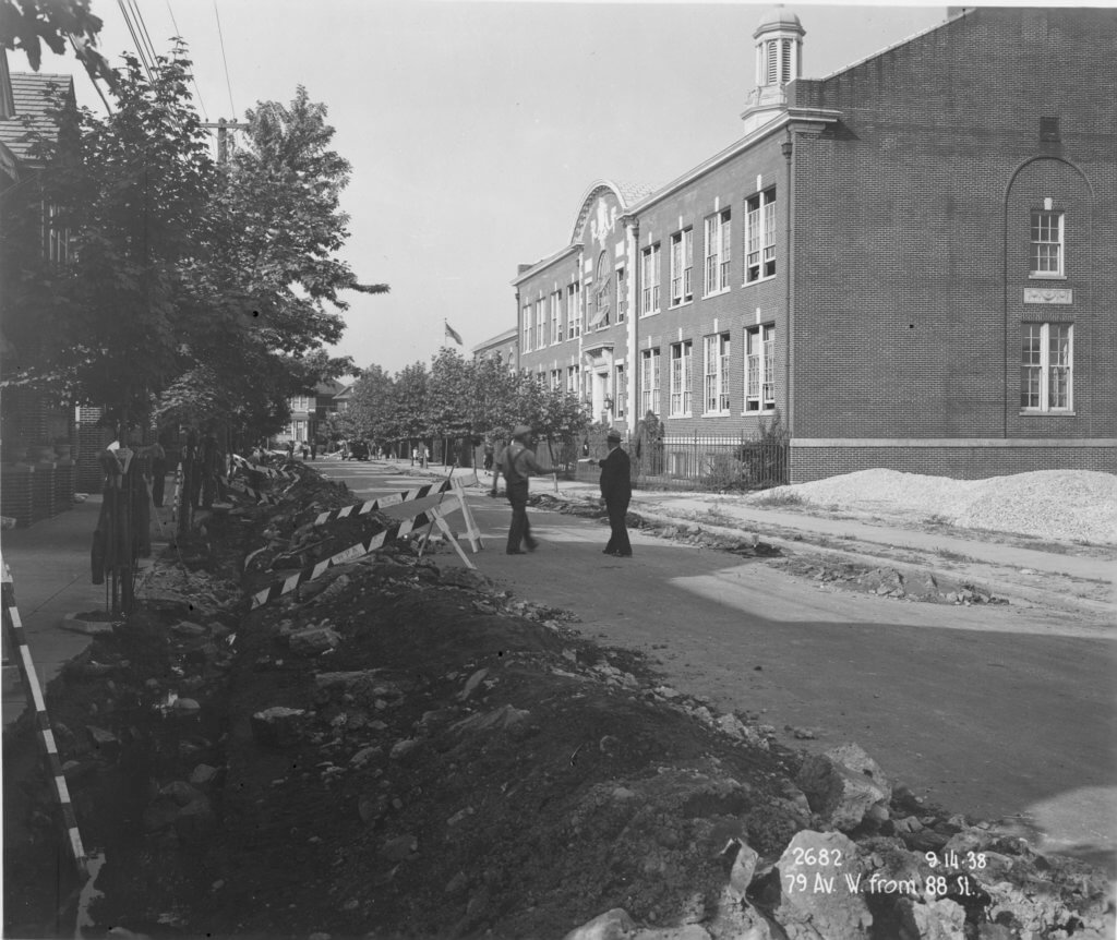
In 1928, P.S. 113 was constructed at 87-21 79th Ave., at 88th Street, for the children of Glendale. Then, on Aug. 14, 1928, Bishop Thomas Molloy of Brooklyn purchased an acre of former Van Dine farmland on the north side of 78th Avenue between 83rd and 85th streets; this would become Sacred Heart Church and School.
On Aug. 1, 1937, Oscar F. Schmidt and Charles Raedel, operating as Van Dine Homes Inc., purchased farm land on the west side of 88th Street and 72nd Avenue. They would build 60 bungalows sold for $5,500 a piece.
Reprinted and edited from the Sept. 5 and Sept. 12, 1985, Ridgewood Times.
* * *
If you have any remembrances or old photographs of “Our Neighborhood: The Way It Was” that you would like to share with our readers, please write to the Old Timer, c/o Ridgewood Times, 38-15 Bell Blvd., Bayside, NY 11361, or send an email to editorial@ridgewoodtimes.com. Any print photographs mailed to us will be carefully returned to you upon request.