Torres/Mayoral Photography Office
Feb. 22, 2018 By Nathaly Pesantez
The city will launch a new ferry route this summer that will connect Long Island City to parts of Manhattan’s Lower East Side.
The Lower East Side Route, the name of the new line, will have terminal points at the 46th Avenue and Center Boulevard landing at the LIC waterfront, and end at Wall St./Pier 11 in Manhattan. Stops in between include East 34th St., Stuyvesant Town, and Corlears Hook.
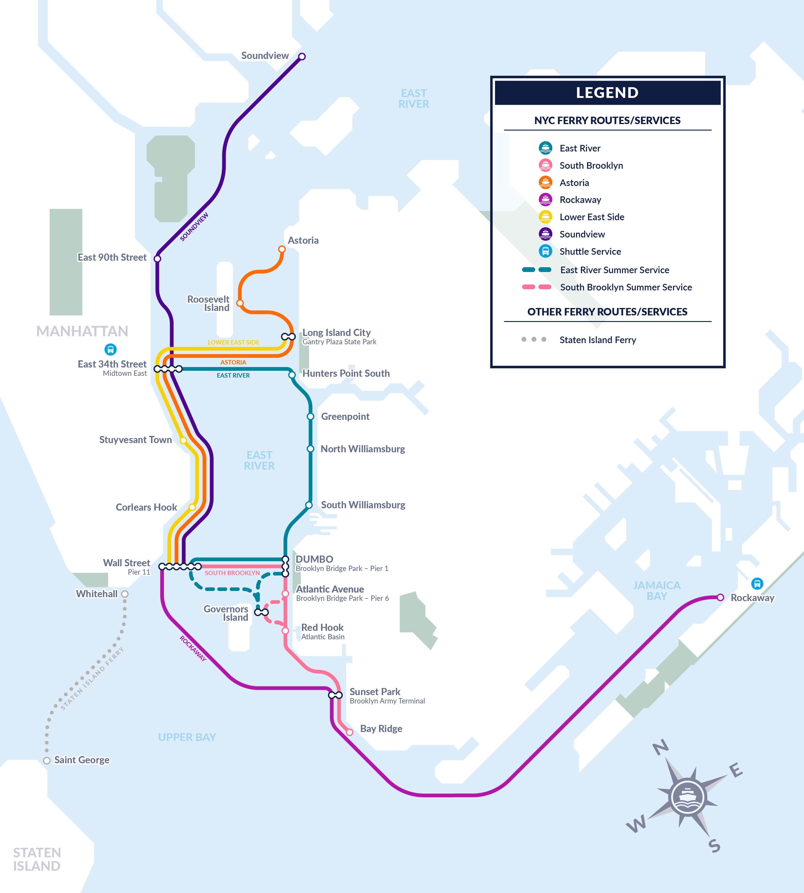
NYC Ferry map showing the LES Route. (EDC)
The total travel time is expected to take 32 minutes, with no more than a 10 minute trip between each stop of the new line.
The route requires new docks at Stuyvesant Town and Corlears Hook, which the city sought approval for last year to build from the Army Corps of Engineers. The Stuyvesant Town dock is located at 20th St. at F.D.R Drive, and involves the construction of a 90-foot-long barge that can hold up to three ferry vessels at a time. The Corlears Hook stop is located by Grand St at the East River Promenade, and will also feature a 90-foot-long barge capable of holding three ferries.
Construction for the new landings began in January, a spokesperson for the Economic Development Corporation said.
Another new line, the Soundview Route, is also expected to launch this summer. The route will connect the Bronx at Clason Point to the Upper East Side and eventually to Wall St./Pier 11 in a trip totaling 54 minutes.
The EDC did not provide the anticipated month of the Lower East Side launch when asked.
The Lo-Down, a hyper-local news site, uploaded photos of the construction underway at Corlears Hook earlier this week.