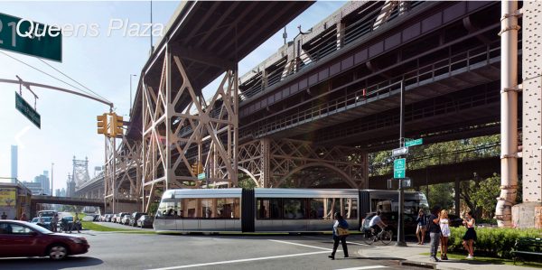
Rendering of the BQX at Queens Plaza (NYC EDC)
Aug. 30, 2018 By Nathaly Pesantez
The city has unveiled an updated plan for its controversial Brooklyn Queens Connector, the street car system planned to run along a number of waterfront neighborhoods of the two boroughs.
The revised route, outlined in the Economic Development Corporation’s conceptual design report, reduces the length of the route by five miles and notably eliminates Sunset Park. The route now goes from Astoria to Red Hook and is 11 miles.
The updated plan also nails down the streetcar’s pathway, and proposes a new bridge between Queens and Brooklyn for the system to run through.
The bridge, with an approximate span of 1,700 feet, would go over Newtown Creek and connect Vernon Boulevard in Long Island City to Greenpoint’s Manhattan Avenue.
The bridge would include a drawbridge span, and will also accommodate cyclists and pedestrians.
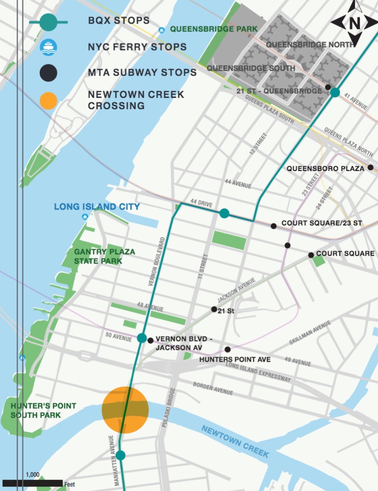
Proposed BQX stops in Long Island City, including the location of a new bridge. (NYC EDC)
On the Long Island City side, the BQX would run through parts of the LIRR rail yard before reaching the crossing point into Brooklyn.
The city does not have to acquire private property for the bridge to go through.
“Both approaches to the creek are on public right-of-way so no property acquisitions are expected for this bridge,” part of the report reads.
The city’s last BQX report was issued in 2016, where it outlined a series of proposed routes and pros and cons for each. The streetcar, for example, was mainly geared for a pathway down 11th Street and over the Pulaski Bridge in Long Island City.
Now, after running through the new bridge, the streetcar would go on Vernon Boulevard all the way to 44th Drive, where it would turn on 21st Street and continue north all the way to a terminus at Astoria Boulevard. A total of six stops are proposed between the terminus and Long Island City before crossing into Brooklyn.
The city says the route here is situated to support the expected growth on the waterfront and the commercial corridor. In addition, the pathway will be designed to be resilient against flooding, allowing service to be quickly restored in case of flooding.
The project is now estimated to cost $2.73 billion, up from the $2.5 million given two years ago. In addition, the city is expecting construction to begin in 2024, rather than 2019, and end in 2029.

The BQX running through the Pulaski Bridge in a prior idea. (NYC EDC)
Furthermore, the city will seek federal funding for the project, a departure from its initial plan to have the streetcar fund itself through value capture, or the money collected from increased property values along the route.
The fare is still expected to be pegged to the bus and subway, with the streetcar running every 5 minutes in peak hours and extending to every 20 minutes during late night hours. Service during overnight hours, however, is still being worked out.
The EDC’s new report comes as the city wrapped up its delayed two-year feasibility study for the project. The project’s feasibility has been a subject of much scrutiny since last year, after a leaked internal memo indicated the streetcar’s financial viability was in doubt.
“The Brooklyn-Queens waterfront has experienced incredible growth. Now it’s time for our transit system to catch up,” said Mayor Bill de Blasio in a statement today. “The BQX is one of the biggest, most ambitious projects in a generation. It will be a challenge, but New York City is taking it on.”
With the green-lighted BQX project, the city said the environmental impact study process will begin this winter, with the public review process known as ULURP to kick off in 2020.
For the full report, click here.