Have you ever wondered about that unmarked building across the street and what the city uses it for? Or how many hospitals and medical clinics are located in your neighborhood?
The city has released a map that outlines city, state and federal facilities in every neighborhood including schools, parks, legal assistance groups and waste sites.
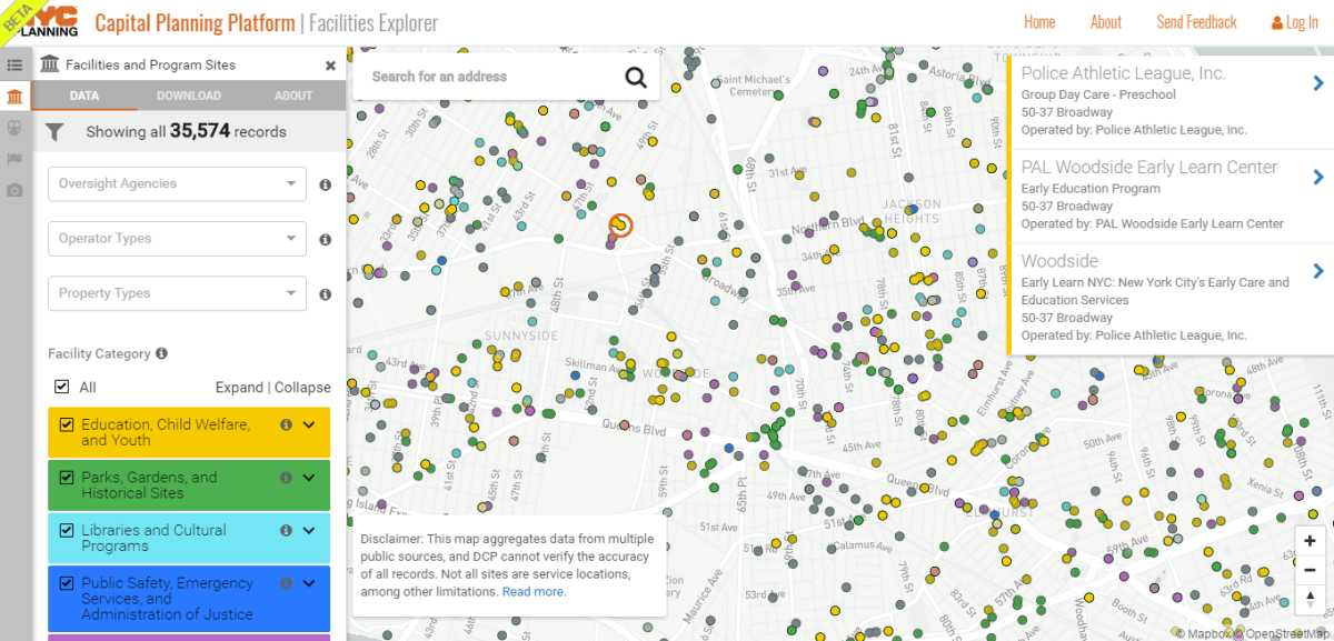
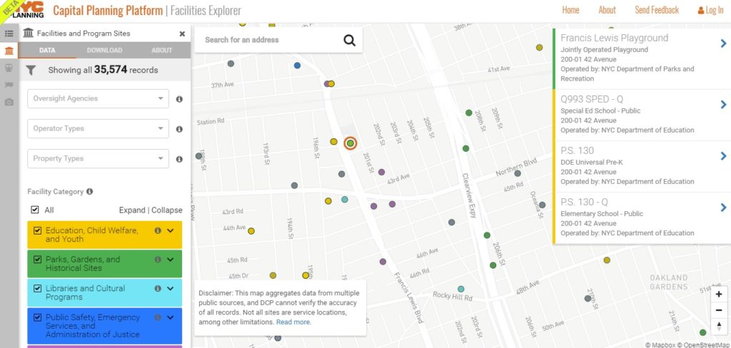
The Facilities Explorer map was created by the Department of City Planning (DCP) by using open source city data to make it easier for planners to collaborate with one another when planning for public investments in neighborhoods. The map aggregates more than 35,000 records from 43 different public data sources provided by city, state and federal agencies.
Each facility is broken down by category including education, child welfare and youth; parks, gardens and historical sites; health and human services; core infrastructure and transportation; libraries and cultural programs; public safety, emergency services, and administration of justice and administration of government.
Residents can view schools, libraries, waste facilities, free legal service clinics, museums, nonprofits, courthouses and more on a block-by-block basis.
While this list is comprehensive, DCP acknowledges that they rely on information provided to them by other agencies so the information may not be completely accurate. Some of the facilities are headquarters and may not be publicly accessible. The agency also warns that there may be duplicates of sites on the map.
Facilities such as homeless shelters are not on this list. According to DCP, some facilities are excluded from the map “to protect the safety and privacy” of clients.
The agency said the map is most helpful to “government employees, civic technologists and New Yorkers who are interested in using this improved data set and mapping platform to build stronger, more equitable neighborhoods.”
To provide feedback about the map and what else should be included, take the agency’s survey here.