The city’s Department of Transportation (DOT) recently delivered a progress report on a program which builds on Mayor Michael Bloomberg’s “PlaNYC 2030” agenda, to transform “The city’s streetscape into people-friendly boulevards and world-class public spaces.”
The initiatives, collectively referred to as “Liveable Streets,” or “Sustainable Streets” utilize “Complete Street” designs to turn “underutilized roadway land into medians [and] pedestrian refuge islands while more than 2 million square feet of former road space are now bike lanes,” according to DOT Commissioner Janette Sadik-Kahn.
Sadik-Khan’s announcement, on Tuesday, July 28 outlined numerous facets of the moves to “green” the city’s blacktop, in line with Intro 199, a bill passed by the City Council and signed into law by Mayor Bloomberg last June.
Under the new law, the DOT will issue an annual report “with indicators to monitor and evaluate levels of congestion and growth in high performance modes including busses, ferries, bicycling and walking.”
The report will include area-wide indicators of traffic, bike and ferry volumes and travel speeds, and data on key corridors where DOT made changes in street design and/or operations.
The idea of the report is to “demonstrate the effectiveness and potential impacts of DOT projects,” according to the announcement.
To that end, the “Complete Streets” principle increases public space and “greening” of streets with bike lanes, planted medians and pedestrian islands. In addition, “many bus and bike lanes specifically incorporate dedicated loading zones to expedite storefront deliveries,” according to the announcement.
Tuesday, August 19 is the deadline for “community partners” to submit proposals for the city’s “Plaza Program,” to create neighborhood plazas throughout the city, to “transform underused streets into vibrant social public spaces.”
According to DOT, this program is a key part of Mayor Bloomberg’s plan to ensure that “all New Yorkers live with a 10-minute walk of quality open space.”
The “Summer Streets,” facet of the plan is the largest program of its kind in the nation, thanks to the temporary 6.9 mile car-free routes from the Brooklyn Bridge to 72nd Street in Manhattan. It also includes smaller-scale projects like the weekend closing of 78th street along a playground in Jackson Heights.
The DOT is also in the midst of the most aggressive expansion of the city’s bike lane network in history. By this July, bike lane mileage has nearly doubled over three years, from 220 to 420 miles.
Vernon Boulevard is the site of an extensive installation of bike lanes, mid-street pedestrian islands and “daylighting,” to advance the overall plan.
Further east in Queens, DOT is also proposing more bike lanes to connect existing ones, and create “bike corridors” so as to make commuting by bicycle a viable choice.
Another DOT program, “Congested Corridors,” has begun to analyze five of the city’s busiest roadways, identified in its “Citywide Congested Corridors Study Project.”
In Queens, Woodhaven Boulevard is the first such route to be slated for analysis to reduce times. According to DOT, Liberty Avenue and Northern Boulevard will be added to the list of routes entering analysis.
Things to do in Queens

Today, 8 pm

Tomorrow, 6:30 pm

Tomorrow, 6:30 pm


July 5, noon
July 5, 6 pm


Latest News
 Far Rockaway’s St. John’s Episcopal Hospital awarded national certification for laboratory excellence
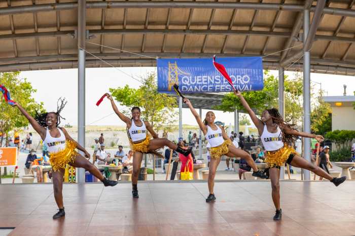
 CUNY dancers bring African diasporic traditions to Queensboro Dance Festival
 Flushing Town Hall’s summer lineup brings jazz to parks and play to the stage
 Millionaire renters surge in NYC as high earners opt for luxury leases: report
 Queens BP backs Jamaica rezoning plan with conditions for housing, schools and jobs
Dining & Nightlife
 Kids eat free at Queens Applebee’s this July 4th weekend
 Akito Japanese Cuisine brings fresh flavors to Bell Boulevard in Bayside
 Tech meets tradition at Dim Sum Bloom’s new Bayside location
 Bayside cool: Momo Ashi’s bubble tea and charm keep customers coming back
 Free Shakespeare in the Park performance coming to Queens Night Market this Saturday
Entertainment
- CUNY dancers bring African diasporic traditions to Queensboro Dance Festival
- Flushing Town Hall’s summer lineup brings jazz to parks and play to the stage
 Astoria Cook Club brings neighbors together through monthly potluck meetups
 Summer events return to Crocheron Park in Bayside
 Free summer concert series returns to Francis Lewis Park in Whitestone
Police & Fire
 Forest Hills home invasion leaves man hospitalized after brutal assault and robbery: NYPD
 California man found shot to death in car near Aqueduct Racetrack on Sunday: NYPD
 Vandal caught red-handed desecrating Holy Family Church statue in Fresh Meadows: NYPD
 Ridgewood man charged with murder in stabbing outside neighborhood bar: NYPD
 Motorcyclist killed after crashing into barrier on Jackie Robinson Parkway in Ridgewood: NYPD
More from Around New York