For many residents of Our Neighborhood in Queens, there just aren’t enough ways to get around without a car.
The Greater Ridgewood area is predominantly served by two subway lines: the M train, which runs through the heart of Ridgewood and ends in Middle Village, and the L train, which straddles the Brooklyn/Queens border with a couple of stops in Ridgewood along the way.
Glendale and Middle Village residents have a long walk (or a bus ride) to take to get to the Middle Village-Metropolitan Avenue stop on the M line — the nearest subway stop to most residents in the communities. Maspeth residents have it the worst: They don’t have access to a subway line without a bus ride to Ridgewood, Middle Village, Elmhurst or Woodside.
In recent years, elected officials in our community have advocated for the creation of additional public transit options to serve the area. Former Councilwoman Elizabeth Crowley proposed a light-rail line along the Long Island Rail Road’s Lower Montauk branch, which is currently used for carrying waste and industrial freight. Current Councilman Robert Holden, meanwhile, supports the creation of the Triboro RX, a Regional Plan Association brainchild which would use commuter and freight lines to create a new rail line serving Brooklyn, Queens and the Bronx.
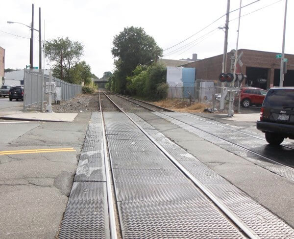
But way before these ideas came to be, the city had proposed creating a new subway line that would cut through the heart of Ridgewood, Glendale and Middle Village — but was soundly rejected by residents at the time.
It was called the “Montauk Options,” and would have extended a new subway line along the aforementioned Lower Montauk branch of the LIRR. We’re grateful to transit expert Joe Raskin for providing us with some details about the proposal:
The Montauk Options were part of the Queens Subway Options Study, which was sort of meant to restart work on some of the lines that were planned as part of the 1968 “New Routes” plan. Work was underway for the 63rd Street and Archer Avenue Lines, along with the Second Avenue Subway when the city budget crisis of the ’70s and ’80s stopped further work.
The original plan had called for the 63rd Street line to extend into Forest Hills, connecting into the Queens Boulevard line near Yellowstone Boulevard. It would have gotten there using right-of-way along the LIRR’s Main Line, with land acquisition needed in Woodside (the right of way was essentially the roadbed once used by the Rockaway Beach Line between Woodside and Rego Park).
Trains would also run to Rosedale via the upper level of the Archer Avenue line and the LIRR right of way. The part of the tunnel that was built (from the Jamaica Center-Parsons/Archer Station to a point somewhere between Liberty Avenue and South Road) is used now to lay up E trains.
The study was essentially a “Where do we go from here?” thing. There were, in effect, five options:
- Going back to the original plan for a connection in Forest Hills, with no physical connection between the 63rd Street and Queens Boulevard lines in Long Island City, aside from a transfer station at Queens Plaza. The City Planning Commission did a whole study on how the Queens Plaza area could be built up around the new station.
- Connection of the two lines in Long Island City. Essentially, this would evolve into what was built; the plan originally called for a connection only with the local tracks.
- The Montauk-LIRR option, terminating the 63rd Street line at a new Queens Plaza Station, putting riders onto LIRR trains there, which would have run along the Montauk Line to Jamaica and points beyond.
- The Montauk-Subway Option, which would have connected the 63rd Street Line with the Montauk Line, incorporating it into the subway system (the Queens Plaza station would have also been built, it would have connected with the J Line at Lefferts Boulevard, running to Archer Avenue’s lower level. In order to build this, the J line as it then existed would have been truncated west of Richmond Hill (I’ve blanked out on where the last stop would have been).
- Do nothing.
A whole series of meetings were held on this, culminating in an MTA public hearing in 1984. The original plan experienced a lot of opposition in Woodside and Forest Hills, due to the amount of land acquisition and construction impact that would have been required.
I don’t recall where the tunnel portal in Forest Hills would have been built, but it’s unimaginable as to how the actual connection would’ve been built in Forest Hills.
Both Montauk Options experienced huge opposition along the length of that line in Ridgewood, Glendale, Maspeth and Richmond Hill. Al D’Amato spoke at the public hearing against them. Many things were cited, including the greatly increased used of the line, vibrations and the need to eliminated grade crossings.
There was very little support in the communities in southeast Queens, who would have benefited the most from the Montauk Options, aside from (to his great credit) Archie Spigner, who talked in favor of them at the public hearing.
As a result, the MTA had little choice but to go with what eventually evolved into the line that was built.
That line, as Raskin mentioned, is the 63rd Street Line that runs between Midtown Manhattan and western Queens via the F line, which went into service in 1989. It also includes a stop at Roosevelt Island, the only rail connection to the residential island in the heart of the East River.
One can only imagine the impact that an extended subway line through Ridgewood, Glendale, Maspeth and Middle Village would have on the community today.
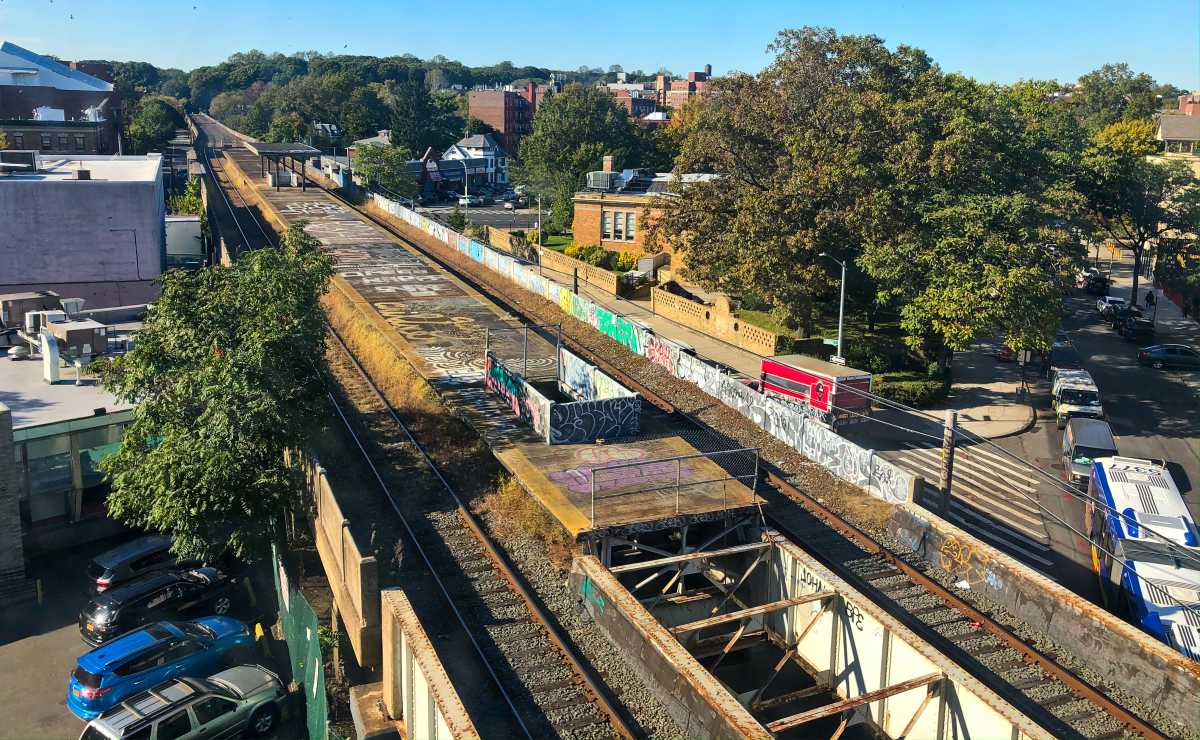
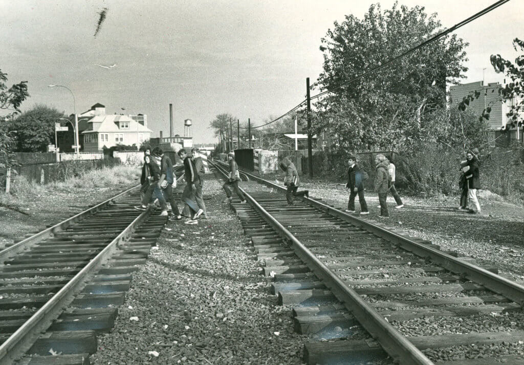
To the best of our knowledge, there were other concerns raised such the potential electrification of the Lower Montauk line to allow subway cars to run along it. It was a valid concern, given the at-grade nature of the line and the propensity for trespassers to cross the tracks, as this 1980s photo shows.
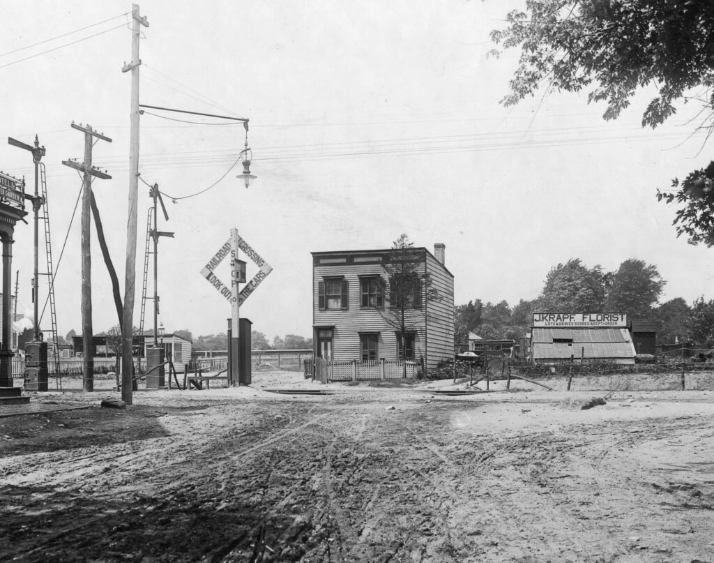
Up until March 1998, the LIRR did run diesel-powered commuter trains along the Lower Montauk line during the morning and afternoon rush hours. These trains stopped at Richmond Hill (near Lefferts Boulevard and Jamaica Avenue), Glendale (near 73rd Street and Edsall Avenue), Fresh Pond (near Metropolitan Avenue and Fresh Pond Road on the Ridgewood/Middle Village border), Haberman (Rust and 50th streets in industrial Maspeth) and Penny Bridge (Review Avenue and Laurel Hill Boulevard in Long Island City).
By the time service was canceled along the line, only a handful of passengers were using the rush-hour trains. Many of these stops were barely constructed as stations at all; the Glendale station, for instance, lacked platforms, with passengers waiting for the trains on the ground on either side of the tracks. Upon arriving, conductors would lower a small stepladder to allow passengers to board and depart.
Part of the reason for the lack of usage may be the lack of a direct connection via the Montauk Branch to Manhattan; it terminates in Long Island City, and Manhattan-bound passengers would have to walk over to the Vernon Boulevard-Jackson Avenue or Hunters Point Avenue stops on the 7 line.
Meanwhile, in southeast Queens, the area’s primary rail service are two passenger lines on the LIRR with stop in neighborhoods such as St. Albans, Laurelton and Rosedale. The service is infrequent and costly; in recent years, the city and MTA agreed upon a discounted ticket program called the “Atlantic Ticket” to make LIRR trips more affordable for residents in the region.
Had the subway line proposed nearly 40 years ago become a reality, trips on that line would be at the standard New York City Transit fare of $2.75.
Old Timer’s note: Joe Raskin’s acclaimed book, “The Routes Not Taken: A Trip Through New York City’s Unbuilt Subway System,” is available for purchase on Amazon and at local book retailers — and you can also borrow it from the Queens Borough Public Library.
* * *
Share your history with us by emailing editorial@ridgewoodtimes.com (subject: Our Neighborhood: The Way it Was) or write to The Old Timer, ℅ Ridgewood Times, 38-15 Bell Blvd., Bayside, NY 11361. Any mailed pictures will be carefully returned to you upon request.

