The city has released the possible routes for the proposed streetcar line along the Brooklyn and Queens waterfront that Mayor Bill de Blasio announced in February.
On Nov. 1, the city Economic Development Corporation (EDC) released a 25-page report outlining feedback from residents. Several planning sessions were held in Astoria, Long Island City and parts of Brooklyn to incorporate feedback from people living along the streetcar route.
The proposed plan would link 10 neighborhoods in a 16-mile route along the East River waterfront. An EDC study found that daily ridership on the Brooklyn Queens Connector would be 48,900 by 2035.
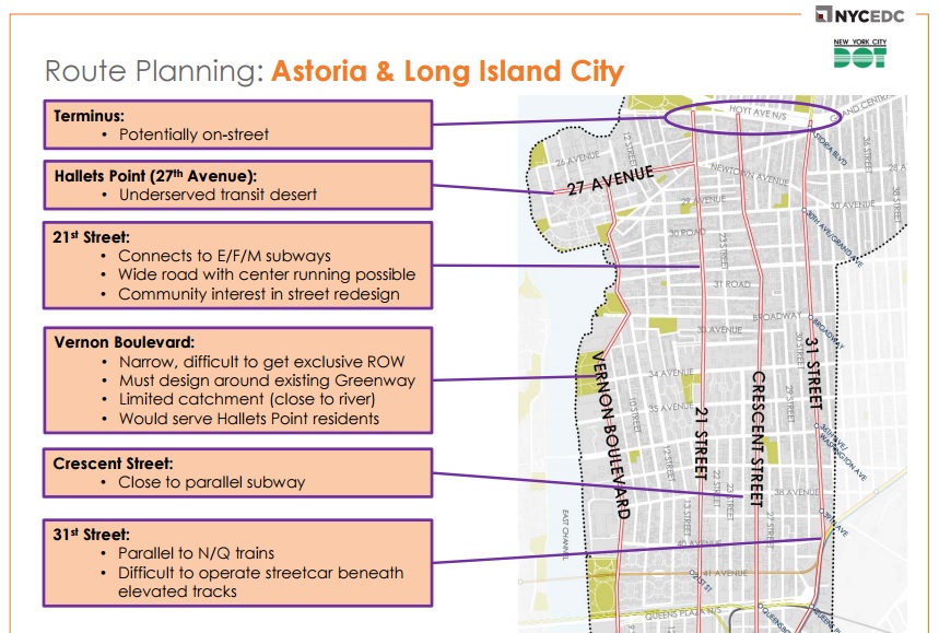
In Astoria, people suggested that the streetcar snake through Vernon Boulevard, 21st Street or 11th Street. The report included these options and more.
One option was 27th Street in Hallets Point, which the report calls an “underserved transit desert.” Some drawbacks to the Vernon Boulevard option included the narrowness of the street and a requirement by the city to design around existing greenway. It would serve Hallets Point residents, which have limited transportation options.
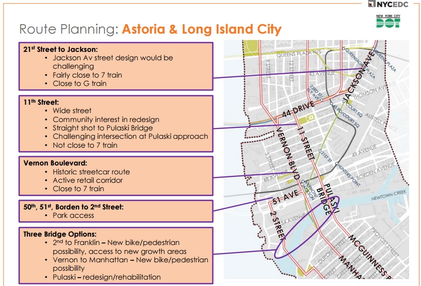
In Long Island City, route options include 21st Street to Jackson Avenue, which would be “challenging” but close to the 7 and G trains.
According to the report, 11th Street would be wide enough and there is already community interest in redesigning it. It would be challenging to install the street car near the Pulaski Bridge and it is not close to the 7 train.
The project would cost approximately $2.5 billion and operations and maintenance are expected to cost $30 million per year. The streetcar is estimated to create $25 billion in economic impact over the next 30 years and to create 28,000 construction jobs.
The city estimates that the Brooklyn Queens Connector would be up and running in 2024. Next year, the city will conduct an environmental review and begin public approval process. In 2018, designs would be finalized and the contractor and operator would be chosen in 2019.

