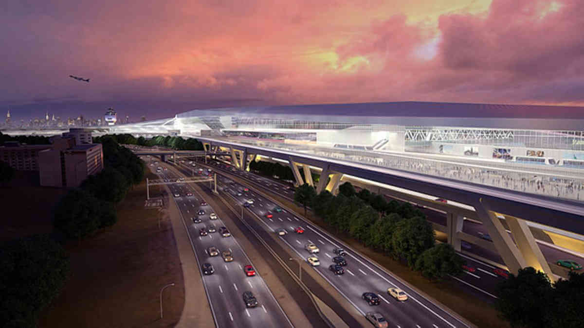
More than a month after the Federal Aviation Administration held its public forums on its plan to construct an AirTrain system to LaGuardia Airport, a letter sent out by the Better Way to LGA Coalition shows that the plan’s proponents are still hungry for data.
At this point, they’re not looking for more community input. They’re looking to a new, more high-tech source of information: apps.
The coalition, an alliance of economic development groups, transportation advocates and unionized labor, recently sent out a letter to Waze, the GPS navigation software app, asking them to share data the app collects that could help the coalition study traffic patterns to and from LaGuardia.
Though the letter asked the tech company to collaborate, it also openly criticized them. “Waze and similar apps help users find the quickest routes to their destinations, often utilizing local roads in order to bypass major highways. But, in shaving off a few minutes of travel time, these apps are pushing traffic into residential neighborhoods which has a negative impact on our local communities,” wrote the coalition members.
The letter’s point about the dissipating effect of navigation apps, suggests the coalition is concerned that they’re underestimating the overall effects of traffic congestion along the Grand Central Parkway leading into the airport.
Tom Grech, president of the Queens Chamber of Commerce and co-chairman of the coalition, played down the responsibility of apps like Waze, emphasizing they are a symptom of the bigger problem that he hopes the AirTrain to fix.
“The big issue is not necessarily just Waze. At the end of the day, there’s been congestion for a very long time in this borough especially around the airport — folks trying to get from Manhattan to LaGuardia. As a chair of the AirTrain Coalition, we are pushing strong to have this rail link put in,” Grech said.
The coalition is not alone in their concern over navigation apps. Peter Beadle, a member of Transportation Alternatives and cycling advocate, said that he’s seen a rise in traffic diverted onto streets that previously were quieter, safer alternative routes for bikers.
Despite his concern over the effects of the app, Beadle said that he thought the data is key in designing transit alternatives that would work to combat the growing traffic congestion in the area.
“Waze doesn’t care how you design your streets; it’s not a player in that fight. All it’s doing is providing routing options,” said Beadle. “In that sense, it’s really at this uninterested third party when it comes to street design, but it’s collecting all this data that will show us how our street design causes congestion.”
Waze responded that it shares the coalition’s goal of reducing congestion and suggested that it is open to partnering city agencies, which it did earlier this year with the MTA and Port Authority to help improve tunnel navigation for cars.
“We are entirely committed to partnering with cities and transit authorities to solve shared transportation challenges,” wrote a spokesperson. “We’re dedicated to eliminating traffic and have been working with the Port Authority and MTA Bridges and Tunnels through our Waze for Cities Program for several years now.”
Grech said that he expects the preliminary results of the environmental study on the AirTrain project to be released by the end of the year.