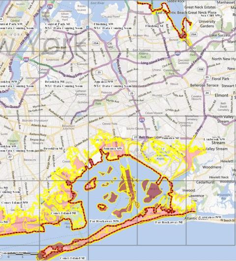
Howard Beach, Lindenwood and Rosedale were added to FEMA’s latest advisory map on flood zone elevation in an attempt to avoid the same volume of flooding and damage experienced during Sandy.
“This is the first in a series of steps on what will become the regulatory guidance,” FEMA coordinating officer Mike Byrne told NY1. “We want to give them the most current data we can.”
This is the first map FEMA has made for the New York City area in 30 years, he said.
Byrne said these maps will prompt home and business owners to rebuild higher than before, and it was FEMA’s goal to get some information out as soon as possible as people want to rebuild now.
The finalized map might not come out for another two years, he said, but the advisory map could be used now on rebuilding homes. A future map would be based on the current advisories and not the older maps, he said.
“At the end of the day this is to sort of eliminate some of the suffering we’ve seen as a result of storms like Sandy,” he said.
RECOMMENDED STORIES